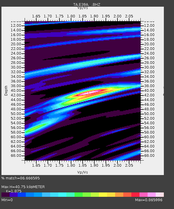
E39A Mellen, WI, USA - Earthquake Result Viewer
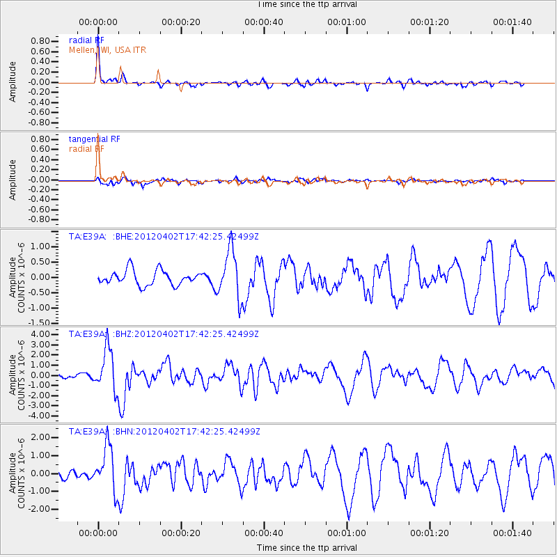
Earthquake location: Near Coast Of Guerrero, Mexico
Earthquake latitude/longitude: 16.4/-98.3
Earthquake time(UTC): 2012/04/02 (093) 17:36:42 GMT
Earthquake Depth: 9.0 km
Earthquake Magnitude: 5.8 MB, 5.9 MS, 6.0 MW, 6.0 MW
Earthquake Catalog/Contributor: WHDF/NEIC
Network: TA USArray Transportable Network (new EarthScope stations)
Station: E39A Mellen, WI, USA
Lat/Lon: 46.38 N/90.56 W
Elevation: 426 m
Distance: 30.6 deg
Az: 10.586 deg
Baz: 194.756 deg
Ray Param: 0.07929421
Estimated Moho Depth: 40.75 km
Estimated Crust Vp/Vs: 1.88
Assumed Crust Vp: 6.467 km/s
Estimated Crust Vs: 3.449 km/s
Estimated Crust Poisson's Ratio: 0.30
Radial Match: 86.666595 %
Radial Bump: 287
Transverse Match: 61.38943 %
Transverse Bump: 400
SOD ConfigId: 445498
Insert Time: 2012-06-23 04:47:06.332 +0000
GWidth: 2.5
Max Bumps: 400
Tol: 0.001

Signal To Noise

ChannelStoNSTALTA
TA:E39A: :BHZ:20120402T17:42:25.42499Z10.546132.1437597E-62.0327452E-7
TA:E39A: :BHN:20120402T17:42:25.42499Z7.4711881.304827E-61.7464787E-7
TA:E39A: :BHE:20120402T17:42:25.42499Z3.43393598.123393E-72.3656216E-7
Arrivals
Ps6.0 SECOND
PpPs17 SECOND
PsPs/PpSs23 SECOND