
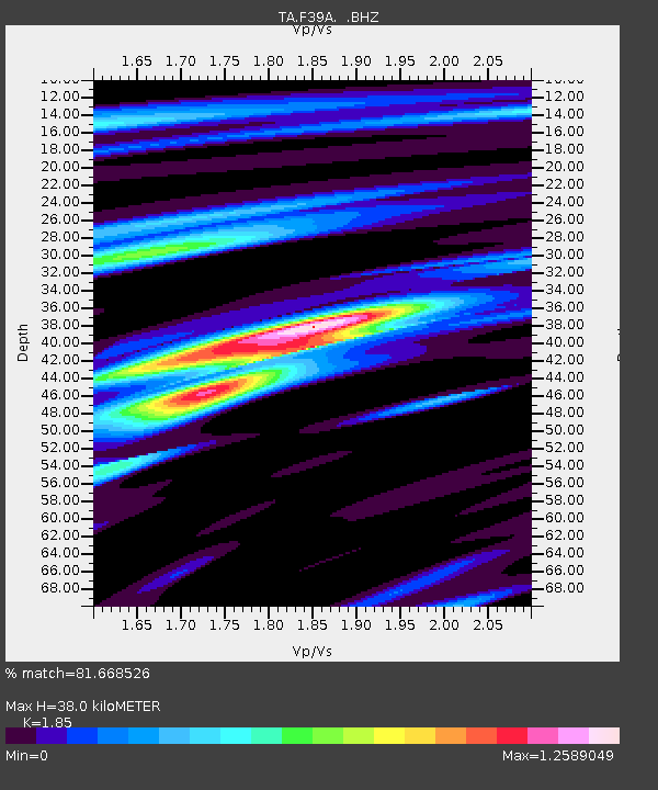
F39A Loretta, WI, USA - Earthquake Result Viewer
| ||||||||||||||||||
| ||||||||||||||||||
| ||||||||||||||||||
|
Signal To Noise
| Channel | StoN | STA | LTA |
| TA:F39A: :BHZ:20120402T17:42:20.92499Z | 7.805865 | 1.7817105E-6 | 2.282528E-7 |
| TA:F39A: :BHN:20120402T17:42:20.92499Z | 6.6483307 | 1.2148105E-6 | 1.8272414E-7 |
| TA:F39A: :BHE:20120402T17:42:20.92499Z | 0.7502765 | 2.0656798E-7 | 2.7532246E-7 |
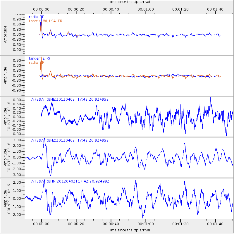
| Arrivals | |
| Ps | 5.3 SECOND |
| PpPs | 15 SECOND |
| PsPs/PpSs | 21 SECOND |

