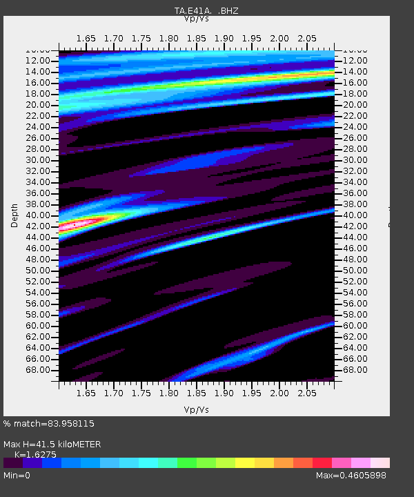
E41A Kenton, MI, USA - Earthquake Result Viewer
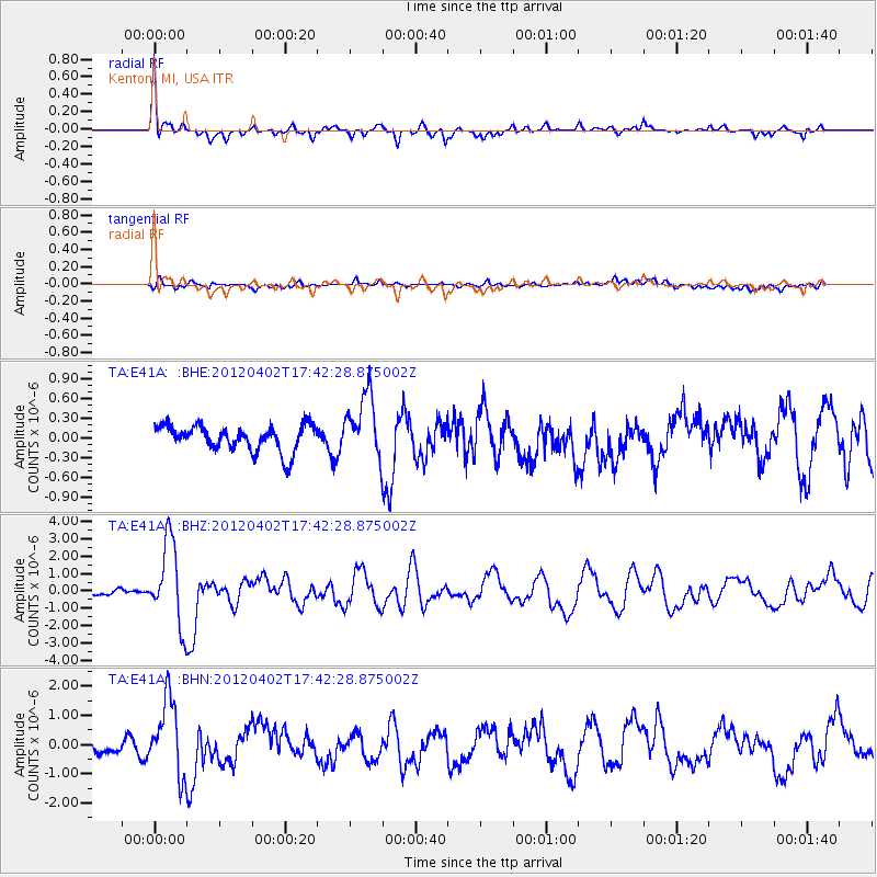
Earthquake location: Near Coast Of Guerrero, Mexico
Earthquake latitude/longitude: 16.4/-98.3
Earthquake time(UTC): 2012/04/02 (093) 17:36:42 GMT
Earthquake Depth: 9.0 km
Earthquake Magnitude: 5.8 MB, 5.9 MS, 6.0 MW, 6.0 MW
Earthquake Catalog/Contributor: WHDF/NEIC
Network: TA USArray Transportable Network (new EarthScope stations)
Station: E41A Kenton, MI, USA
Lat/Lon: 46.46 N/88.96 W
Elevation: 377 m
Distance: 31.0 deg
Az: 12.606 deg
Baz: 197.641 deg
Ray Param: 0.079191625
Estimated Moho Depth: 41.5 km
Estimated Crust Vp/Vs: 1.63
Assumed Crust Vp: 6.467 km/s
Estimated Crust Vs: 3.973 km/s
Estimated Crust Poisson's Ratio: 0.20
Radial Match: 83.958115 %
Radial Bump: 400
Transverse Match: 64.44506 %
Transverse Bump: 400
SOD ConfigId: 445498
Insert Time: 2012-06-23 04:47:29.100 +0000
GWidth: 2.5
Max Bumps: 400
Tol: 0.001

Signal To Noise

ChannelStoNSTALTA
TA:E41A: :BHZ:20120402T17:42:28.875002Z7.80906722.3626812E-63.0255615E-7
TA:E41A: :BHN:20120402T17:42:28.875002Z4.830411.2931066E-62.677012E-7
TA:E41A: :BHE:20120402T17:42:28.875002Z2.49573354.8583854E-71.9466763E-7
Arrivals
Ps4.4 SECOND
PpPs15 SECOND
PsPs/PpSs20 SECOND