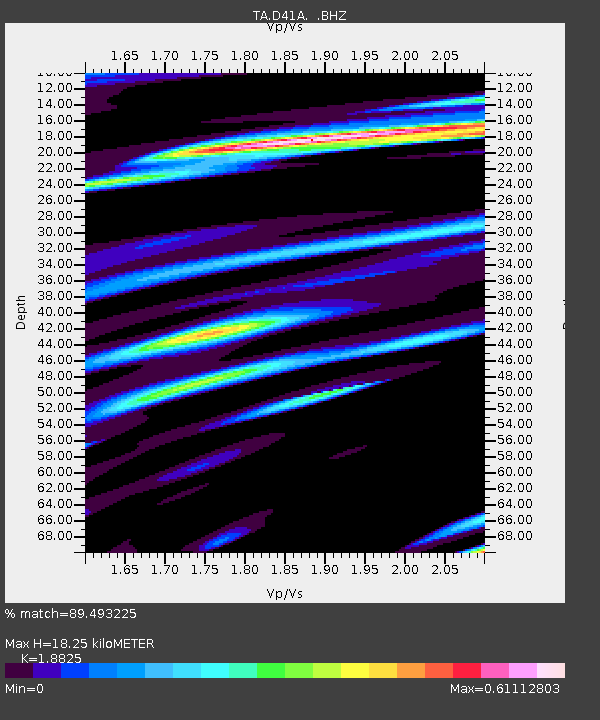
D41A Chassel, MI, USA - Earthquake Result Viewer
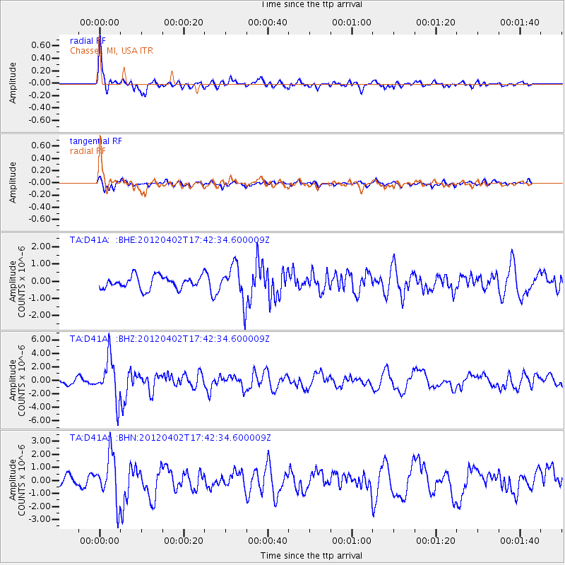
Earthquake location: Near Coast Of Guerrero, Mexico
Earthquake latitude/longitude: 16.4/-98.3
Earthquake time(UTC): 2012/04/02 (093) 17:36:42 GMT
Earthquake Depth: 9.0 km
Earthquake Magnitude: 5.8 MB, 5.9 MS, 6.0 MW, 6.0 MW
Earthquake Catalog/Contributor: WHDF/NEIC
Network: TA USArray Transportable Network (new EarthScope stations)
Station: D41A Chassel, MI, USA
Lat/Lon: 47.06 N/88.57 W
Elevation: 271 m
Distance: 31.6 deg
Az: 12.755 deg
Baz: 198.058 deg
Ray Param: 0.07899783
Estimated Moho Depth: 18.25 km
Estimated Crust Vp/Vs: 1.88
Assumed Crust Vp: 6.467 km/s
Estimated Crust Vs: 3.435 km/s
Estimated Crust Poisson's Ratio: 0.30
Radial Match: 89.493225 %
Radial Bump: 391
Transverse Match: 66.656845 %
Transverse Bump: 400
SOD ConfigId: 445498
Insert Time: 2012-06-23 04:47:34.054 +0000
GWidth: 2.5
Max Bumps: 400
Tol: 0.001

Signal To Noise

ChannelStoNSTALTA
TA:D41A: :BHZ:20120402T17:42:34.600009Z9.0760293.1350614E-63.4542217E-7
TA:D41A: :BHN:20120402T17:42:34.600009Z4.8883011.8334274E-63.7506433E-7
TA:D41A: :BHE:20120402T17:42:34.600009Z2.9691811.0869733E-63.6608517E-7
Arrivals
Ps2.7 SECOND
PpPs7.5 SECOND
PsPs/PpSs10 SECOND