
G43A Wallace, MI, USA - Earthquake Result Viewer
| ||||||||||||||||||
| ||||||||||||||||||
| ||||||||||||||||||
|
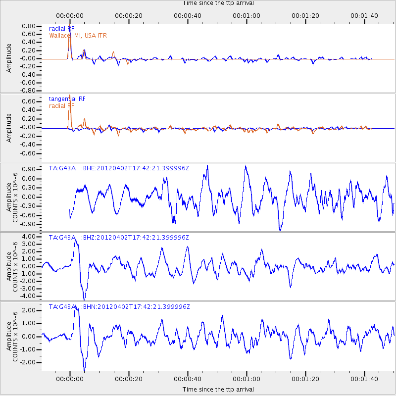
Signal To Noise
| Channel | StoN | STA | LTA |
| TA:G43A: :BHZ:20120402T17:42:21.399996Z | 5.2718463 | 2.3560044E-6 | 4.4690307E-7 |
| TA:G43A: :BHN:20120402T17:42:21.399996Z | 11.945006 | 1.3969711E-6 | 1.1695022E-7 |
| TA:G43A: :BHE:20120402T17:42:21.399996Z | 1.3518872 | 3.8410852E-7 | 2.8412762E-7 |
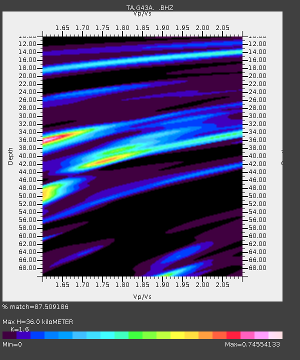
| Arrivals | |
| Ps | 3.6 SECOND |
| PpPs | 13 SECOND |
| PsPs/PpSs | 17 SECOND |

