You are here: Home > Network List > G - GEOSCOPE Stations List
> Station INU Inuyama, Japan > Earthquake Result Viewer
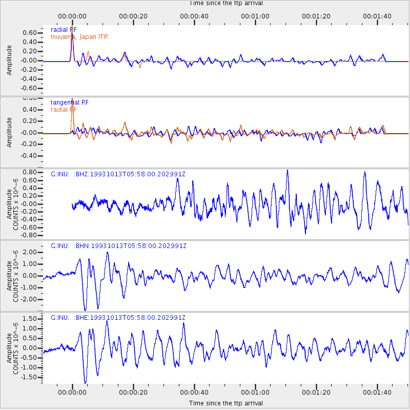
INU Inuyama, Japan - Earthquake Result Viewer
*The percent match for this event was below the threshold and hence no stack was calculated.
| Earthquake location: |
Eastern New Guinea Reg., P.N.G. |
| Earthquake latitude/longitude: |
-6.0/146.1 |
| Earthquake time(UTC): |
1993/10/13 (286) 05:50:42 GMT |
| Earthquake Depth: |
33 km |
| Earthquake Magnitude: |
5.6 MB, 5.9 MS, 6.1 ML |
| Earthquake Catalog/Contributor: |
WHDF/NEIC |
|
| Network: |
G GEOSCOPE |
| Station: |
INU Inuyama, Japan |
| Lat/Lon: |
35.35 N/137.03 E |
| Elevation: |
132 m |
|
| Distance: |
42.0 deg |
| Az: |
348.85 deg |
| Baz: |
166.393 deg |
| Ray Param: |
$rayparam |
*The percent match for this event was below the threshold and hence was not used in the summary stack. |
|
| Radial Match: |
79.06801 % |
| Radial Bump: |
380 |
| Transverse Match: |
64.26817 % |
| Transverse Bump: |
400 |
| SOD ConfigId: |
4480 |
| Insert Time: |
2010-02-26 23:26:23.248 +0000 |
| GWidth: |
2.5 |
| Max Bumps: |
400 |
| Tol: |
0.001 |
|
Signal To Noise
| Channel | StoN | STA | LTA |
| G:INU: :BHN:19931013T05:58:00.202991Z | 8.855614 | 1.3485683E-6 | 1.52284E-7 |
| G:INU: :BHE:19931013T05:58:00.202991Z | 3.6464741 | 7.761666E-7 | 2.12854E-7 |
| G:INU: :BHZ:19931013T05:58:00.202991Z | 2.6209505 | 2.64585E-7 | 1.00950025E-7 |
| Arrivals |
| Ps | |
| PpPs | |
| PsPs/PpSs | |


