You are here: Home > Network List > G - GEOSCOPE Stations List
> Station INU Inuyama, Japan > Earthquake Result Viewer
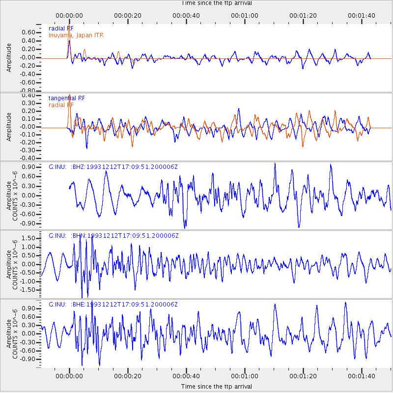
INU Inuyama, Japan - Earthquake Result Viewer
*The percent match for this event was below the threshold and hence no stack was calculated.
| Earthquake location: |
Northern Molucca Sea |
| Earthquake latitude/longitude: |
0.3/126.0 |
| Earthquake time(UTC): |
1993/12/12 (346) 17:03:20 GMT |
| Earthquake Depth: |
33 km |
| Earthquake Magnitude: |
5.8 MB, 5.6 MS |
| Earthquake Catalog/Contributor: |
WHDF/NEIC |
|
| Network: |
G GEOSCOPE |
| Station: |
INU Inuyama, Japan |
| Lat/Lon: |
35.35 N/137.03 E |
| Elevation: |
132 m |
|
| Distance: |
36.4 deg |
| Az: |
15.351 deg |
| Baz: |
198.896 deg |
| Ray Param: |
$rayparam |
*The percent match for this event was below the threshold and hence was not used in the summary stack. |
|
| Radial Match: |
66.2172 % |
| Radial Bump: |
400 |
| Transverse Match: |
62.206142 % |
| Transverse Bump: |
400 |
| SOD ConfigId: |
4480 |
| Insert Time: |
2010-02-26 23:26:32.142 +0000 |
| GWidth: |
2.5 |
| Max Bumps: |
400 |
| Tol: |
0.001 |
|
Signal To Noise
| Channel | StoN | STA | LTA |
| G:INU: :BHN:19931212T17:09:51.200006Z | 2.4995675 | 7.4317296E-7 | 2.973206E-7 |
| G:INU: :BHE:19931212T17:09:51.200006Z | 1.4627813 | 4.4405434E-7 | 3.0356853E-7 |
| G:INU: :BHZ:19931212T17:09:51.200006Z | 0.80237895 | 2.715217E-7 | 3.3839584E-7 |
| Arrivals |
| Ps | |
| PpPs | |
| PsPs/PpSs | |


