You are here: Home > Network List > TA - USArray Transportable Network (new EarthScope stations) Stations List
> Station N46A Monticello, IN, USA > Earthquake Result Viewer
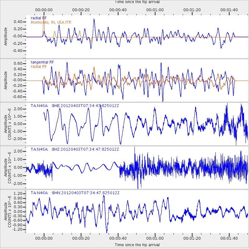
N46A Monticello, IN, USA - Earthquake Result Viewer
*The percent match for this event was below the threshold and hence no stack was calculated.
| Earthquake location: |
Northern Chile |
| Earthquake latitude/longitude: |
-19.6/-69.1 |
| Earthquake time(UTC): |
2012/04/03 (094) 07:25:08 GMT |
| Earthquake Depth: |
117 km |
| Earthquake Magnitude: |
5.5 ML, 5.2 MB |
| Earthquake Catalog/Contributor: |
WHDF/NEIC |
|
| Network: |
TA USArray Transportable Network (new EarthScope stations) |
| Station: |
N46A Monticello, IN, USA |
| Lat/Lon: |
40.89 N/86.74 W |
| Elevation: |
209 m |
|
| Distance: |
62.4 deg |
| Az: |
344.976 deg |
| Baz: |
161.198 deg |
| Ray Param: |
$rayparam |
*The percent match for this event was below the threshold and hence was not used in the summary stack. |
|
| Radial Match: |
43.96961 % |
| Radial Bump: |
400 |
| Transverse Match: |
44.98106 % |
| Transverse Bump: |
392 |
| SOD ConfigId: |
445498 |
| Insert Time: |
2012-06-23 05:21:01.462 +0000 |
| GWidth: |
2.5 |
| Max Bumps: |
400 |
| Tol: |
0.001 |
|
Signal To Noise
| Channel | StoN | STA | LTA |
| TA:N46A: :BHZ:20120403T07:34:47.825012Z | 1.7750406 | 5.1790096E-7 | 2.917685E-7 |
| TA:N46A: :BHN:20120403T07:34:47.825012Z | 2.0068367 | 5.5756755E-7 | 2.7783406E-7 |
| TA:N46A: :BHE:20120403T07:34:47.825012Z | 0.99092215 | 1.2110047E-6 | 1.2220987E-6 |
| Arrivals |
| Ps | |
| PpPs | |
| PsPs/PpSs | |


