You are here: Home > Network List > G - GEOSCOPE Stations List
> Station INU Inuyama, Japan > Earthquake Result Viewer
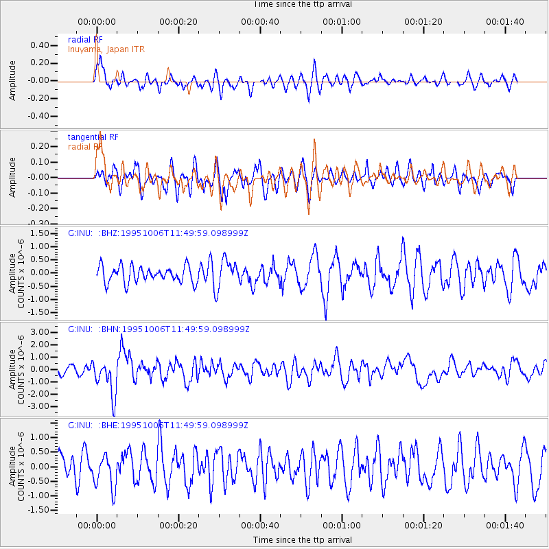
INU Inuyama, Japan - Earthquake Result Viewer
*The percent match for this event was below the threshold and hence no stack was calculated.
| Earthquake location: |
Tonga Islands |
| Earthquake latitude/longitude: |
-20.0/-175.9 |
| Earthquake time(UTC): |
1995/10/06 (279) 11:39:36 GMT |
| Earthquake Depth: |
209 km |
| Earthquake Magnitude: |
5.7 MB, 6.4 UNKNOWN, 6.3 MW |
| Earthquake Catalog/Contributor: |
WHDF/NEIC |
|
| Network: |
G GEOSCOPE |
| Station: |
INU Inuyama, Japan |
| Lat/Lon: |
35.35 N/137.03 E |
| Elevation: |
132 m |
|
| Distance: |
70.9 deg |
| Az: |
320.706 deg |
| Baz: |
133.242 deg |
| Ray Param: |
$rayparam |
*The percent match for this event was below the threshold and hence was not used in the summary stack. |
|
| Radial Match: |
57.808353 % |
| Radial Bump: |
400 |
| Transverse Match: |
57.367577 % |
| Transverse Bump: |
400 |
| SOD ConfigId: |
4480 |
| Insert Time: |
2010-02-26 23:26:35.854 +0000 |
| GWidth: |
2.5 |
| Max Bumps: |
400 |
| Tol: |
0.001 |
|
Signal To Noise
| Channel | StoN | STA | LTA |
| G:INU: :BHN:19951006T11:49:59.098999Z | 3.5541027 | 1.5064052E-6 | 4.2384966E-7 |
| G:INU: :BHE:19951006T11:49:59.098999Z | 1.3203186 | 6.017345E-7 | 4.557495E-7 |
| G:INU: :BHZ:19951006T11:49:59.098999Z | 1.8088275 | 5.4698006E-7 | 3.023948E-7 |
| Arrivals |
| Ps | |
| PpPs | |
| PsPs/PpSs | |


