You are here: Home > Network List > G - GEOSCOPE Stations List
> Station INU Inuyama, Japan > Earthquake Result Viewer
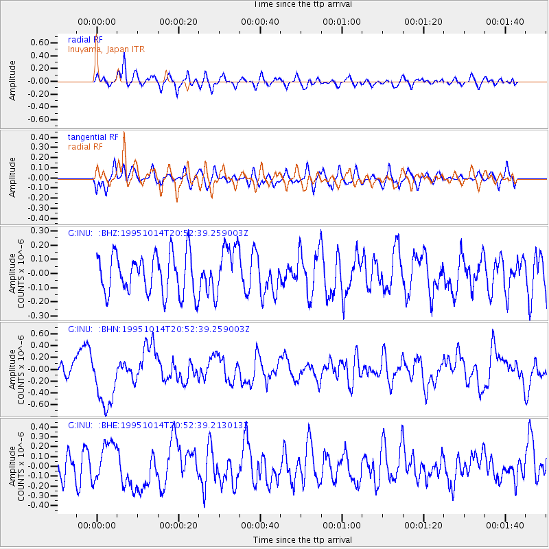
INU Inuyama, Japan - Earthquake Result Viewer
*The percent match for this event was below the threshold and hence no stack was calculated.
| Earthquake location: |
Solomon Islands |
| Earthquake latitude/longitude: |
-6.4/154.5 |
| Earthquake time(UTC): |
1995/10/14 (287) 20:45:00 GMT |
| Earthquake Depth: |
33 km |
| Earthquake Magnitude: |
5.2 MB, 5.9 MS, 6.1 UNKNOWN, 6.0 MW |
| Earthquake Catalog/Contributor: |
WHDF/NEIC |
|
| Network: |
G GEOSCOPE |
| Station: |
INU Inuyama, Japan |
| Lat/Lon: |
35.35 N/137.03 E |
| Elevation: |
132 m |
|
| Distance: |
44.7 deg |
| Az: |
339.565 deg |
| Baz: |
154.883 deg |
| Ray Param: |
$rayparam |
*The percent match for this event was below the threshold and hence was not used in the summary stack. |
|
| Radial Match: |
59.728443 % |
| Radial Bump: |
400 |
| Transverse Match: |
61.776646 % |
| Transverse Bump: |
400 |
| SOD ConfigId: |
4480 |
| Insert Time: |
2010-02-26 23:26:43.510 +0000 |
| GWidth: |
2.5 |
| Max Bumps: |
400 |
| Tol: |
0.001 |
|
Signal To Noise
| Channel | StoN | STA | LTA |
| G:INU: :BHN:19951014T20:52:39.259003Z | 6.3407345 | 4.829498E-7 | 7.616622E-8 |
| G:INU: :BHE:19951014T20:52:39.213013Z | 2.1281793 | 2.0544962E-7 | 9.653773E-8 |
| G:INU: :BHZ:19951014T20:52:39.259003Z | 1.2799003 | 1.7983298E-7 | 1.4050546E-7 |
| Arrivals |
| Ps | |
| PpPs | |
| PsPs/PpSs | |


