You are here: Home > Network List > G - GEOSCOPE Stations List
> Station INU Inuyama, Japan > Earthquake Result Viewer
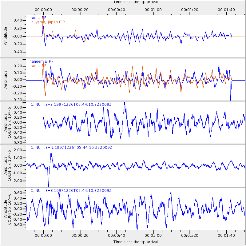
INU Inuyama, Japan - Earthquake Result Viewer
*The percent match for this event was below the threshold and hence no stack was calculated.
| Earthquake location: |
South Of Fiji Islands |
| Earthquake latitude/longitude: |
-22.3/-179.7 |
| Earthquake time(UTC): |
1997/12/26 (360) 05:34:24 GMT |
| Earthquake Depth: |
588 km |
| Earthquake Magnitude: |
5.9 UNKNOWN, 5.3 MB, 5.8 MW |
| Earthquake Catalog/Contributor: |
WHDF/NEIC |
|
| Network: |
G GEOSCOPE |
| Station: |
INU Inuyama, Japan |
| Lat/Lon: |
35.35 N/137.03 E |
| Elevation: |
132 m |
|
| Distance: |
70.5 deg |
| Az: |
323.528 deg |
| Baz: |
137.682 deg |
| Ray Param: |
$rayparam |
*The percent match for this event was below the threshold and hence was not used in the summary stack. |
|
| Radial Match: |
48.77899 % |
| Radial Bump: |
400 |
| Transverse Match: |
67.25706 % |
| Transverse Bump: |
400 |
| SOD ConfigId: |
4480 |
| Insert Time: |
2010-02-26 23:26:47.720 +0000 |
| GWidth: |
2.5 |
| Max Bumps: |
400 |
| Tol: |
0.001 |
|
Signal To Noise
| Channel | StoN | STA | LTA |
| G:INU: :BHN:19971226T05:44:10.322009Z | 4.6709914 | 9.720555E-7 | 2.0810477E-7 |
| G:INU: :BHE:19971226T05:44:10.322009Z | 1.2865887 | 3.2974916E-7 | 2.5629728E-7 |
| G:INU: :BHZ:19971226T05:44:10.322009Z | 1.3189285 | 2.353717E-7 | 1.7845676E-7 |
| Arrivals |
| Ps | |
| PpPs | |
| PsPs/PpSs | |


