You are here: Home > Network List > G - GEOSCOPE Stations List
> Station INU Inuyama, Japan > Earthquake Result Viewer
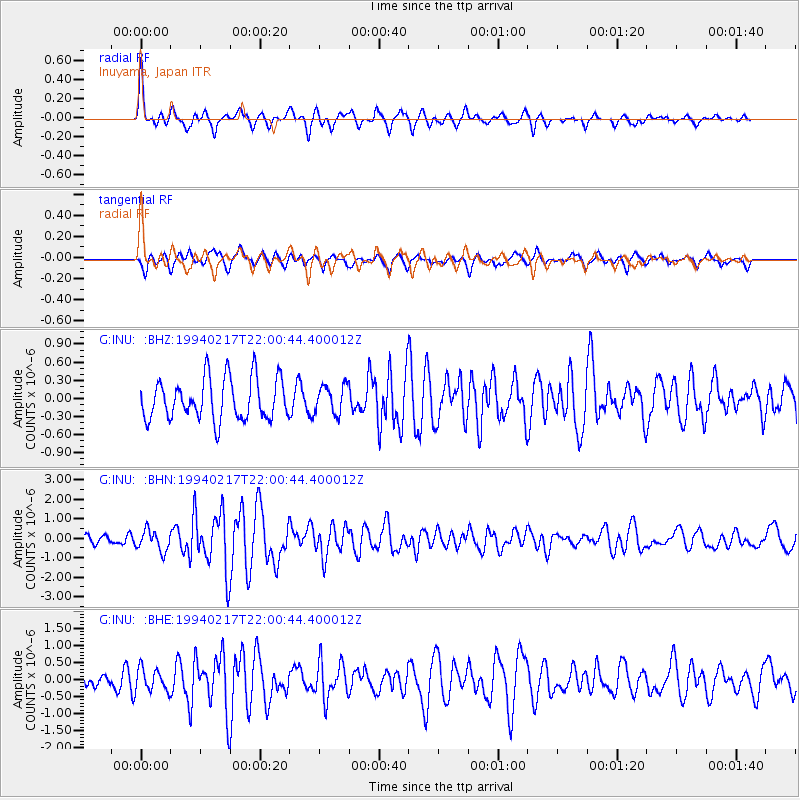
INU Inuyama, Japan - Earthquake Result Viewer
*The percent match for this event was below the threshold and hence no stack was calculated.
| Earthquake location: |
D'Entrecasteaux Islands Region |
| Earthquake latitude/longitude: |
-9.5/152.1 |
| Earthquake time(UTC): |
1994/02/17 (048) 21:52:47 GMT |
| Earthquake Depth: |
25 km |
| Earthquake Magnitude: |
5.8 MS, 5.2 MB |
| Earthquake Catalog/Contributor: |
WHDF/NEIC |
|
| Network: |
G GEOSCOPE |
| Station: |
INU Inuyama, Japan |
| Lat/Lon: |
35.35 N/137.03 E |
| Elevation: |
132 m |
|
| Distance: |
46.8 deg |
| Az: |
343.092 deg |
| Baz: |
159.453 deg |
| Ray Param: |
$rayparam |
*The percent match for this event was below the threshold and hence was not used in the summary stack. |
|
| Radial Match: |
67.6692 % |
| Radial Bump: |
400 |
| Transverse Match: |
70.41326 % |
| Transverse Bump: |
400 |
| SOD ConfigId: |
4480 |
| Insert Time: |
2010-02-26 23:26:54.427 +0000 |
| GWidth: |
2.5 |
| Max Bumps: |
400 |
| Tol: |
0.001 |
|
Signal To Noise
| Channel | StoN | STA | LTA |
| G:INU: :BHN:19940217T22:00:44.400012Z | 2.555058 | 5.313443E-7 | 2.0795783E-7 |
| G:INU: :BHE:19940217T22:00:44.400012Z | 1.3574213 | 3.2806392E-7 | 2.4168173E-7 |
| G:INU: :BHZ:19940217T22:00:44.400012Z | 0.68918 | 2.359093E-7 | 3.423043E-7 |
| Arrivals |
| Ps | |
| PpPs | |
| PsPs/PpSs | |


