You are here: Home > Network List > TA - USArray Transportable Network (new EarthScope stations) Stations List
> Station Q41A Truxton, MO, USA > Earthquake Result Viewer
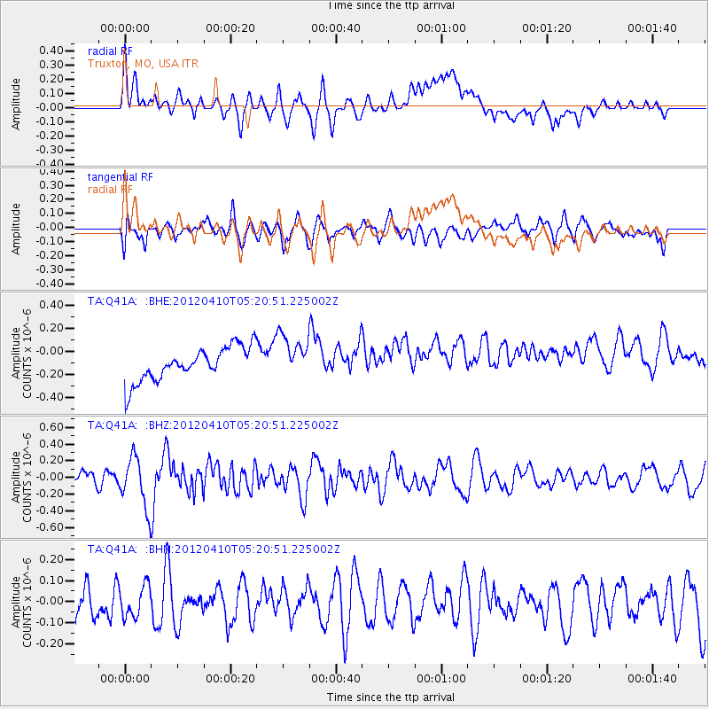
Q41A Truxton, MO, USA - Earthquake Result Viewer
*The percent match for this event was below the threshold and hence no stack was calculated.
| Earthquake location: |
North Of Ascension Island |
| Earthquake latitude/longitude: |
-1.3/-14.0 |
| Earthquake time(UTC): |
2012/04/10 (101) 05:09:08 GMT |
| Earthquake Depth: |
10 km |
| Earthquake Magnitude: |
5.8 MW, 5.4 MS, 5.4 MB, 5.8 MW |
| Earthquake Catalog/Contributor: |
WHDF/NEIC |
|
| Network: |
TA USArray Transportable Network (new EarthScope stations) |
| Station: |
Q41A Truxton, MO, USA |
| Lat/Lon: |
38.95 N/91.23 W |
| Elevation: |
191 m |
|
| Distance: |
80.9 deg |
| Az: |
309.627 deg |
| Baz: |
99.037 deg |
| Ray Param: |
$rayparam |
*The percent match for this event was below the threshold and hence was not used in the summary stack. |
|
| Radial Match: |
46.718132 % |
| Radial Bump: |
400 |
| Transverse Match: |
54.426834 % |
| Transverse Bump: |
400 |
| SOD ConfigId: |
446234 |
| Insert Time: |
2012-07-04 09:09:37.984 +0000 |
| GWidth: |
2.5 |
| Max Bumps: |
400 |
| Tol: |
0.001 |
|
Signal To Noise
| Channel | StoN | STA | LTA |
| TA:Q41A: :BHZ:20120410T05:20:51.225002Z | 2.9305453 | 3.033456E-7 | 1.0351165E-7 |
| TA:Q41A: :BHN:20120410T05:20:51.225002Z | 0.8752509 | 7.399131E-8 | 8.453726E-8 |
| TA:Q41A: :BHE:20120410T05:20:51.225002Z | 1.3002177 | 1.878071E-7 | 1.4444281E-7 |
| Arrivals |
| Ps | |
| PpPs | |
| PsPs/PpSs | |


