You are here: Home > Network List > TA - USArray Transportable Network (new EarthScope stations) Stations List
> Station 452A Marianna, FL, USA > Earthquake Result Viewer
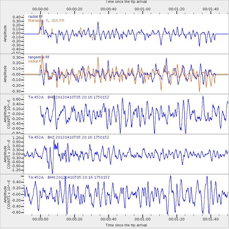
452A Marianna, FL, USA - Earthquake Result Viewer
*The percent match for this event was below the threshold and hence no stack was calculated.
| Earthquake location: |
North Of Ascension Island |
| Earthquake latitude/longitude: |
-1.3/-14.0 |
| Earthquake time(UTC): |
2012/04/10 (101) 05:09:08 GMT |
| Earthquake Depth: |
10 km |
| Earthquake Magnitude: |
5.8 MW, 5.4 MS, 5.4 MB, 5.8 MW |
| Earthquake Catalog/Contributor: |
WHDF/NEIC |
|
| Network: |
TA USArray Transportable Network (new EarthScope stations) |
| Station: |
452A Marianna, FL, USA |
| Lat/Lon: |
30.85 N/85.18 W |
| Elevation: |
35 m |
|
| Distance: |
74.6 deg |
| Az: |
302.373 deg |
| Baz: |
100.949 deg |
| Ray Param: |
$rayparam |
*The percent match for this event was below the threshold and hence was not used in the summary stack. |
|
| Radial Match: |
60.228745 % |
| Radial Bump: |
371 |
| Transverse Match: |
53.634636 % |
| Transverse Bump: |
374 |
| SOD ConfigId: |
446234 |
| Insert Time: |
2012-07-04 09:11:30.432 +0000 |
| GWidth: |
2.5 |
| Max Bumps: |
400 |
| Tol: |
0.001 |
|
Signal To Noise
| Channel | StoN | STA | LTA |
| TA:452A: :BHZ:20120410T05:20:16.175015Z | 2.0836408 | 3.8949923E-7 | 1.8693204E-7 |
| TA:452A: :BHN:20120410T05:20:16.175015Z | 0.6743542 | 1.6886044E-7 | 2.504032E-7 |
| TA:452A: :BHE:20120410T05:20:16.175015Z | 0.666871 | 1.6265786E-7 | 2.43912E-7 |
| Arrivals |
| Ps | |
| PpPs | |
| PsPs/PpSs | |


