You are here: Home > Network List > G - GEOSCOPE Stations List
> Station INU Inuyama, Japan > Earthquake Result Viewer
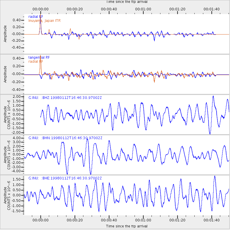
INU Inuyama, Japan - Earthquake Result Viewer
*The percent match for this event was below the threshold and hence no stack was calculated.
| Earthquake location: |
Fiji Islands Region |
| Earthquake latitude/longitude: |
-15.8/-179.4 |
| Earthquake time(UTC): |
1998/01/12 (012) 16:36:20 GMT |
| Earthquake Depth: |
23 km |
| Earthquake Magnitude: |
5.8 MB, 6.7 MS, 6.9 UNKNOWN, 6.7 MW |
| Earthquake Catalog/Contributor: |
WHDF/NEIC |
|
| Network: |
G GEOSCOPE |
| Station: |
INU Inuyama, Japan |
| Lat/Lon: |
35.35 N/137.03 E |
| Elevation: |
132 m |
|
| Distance: |
65.6 deg |
| Az: |
321.75 deg |
| Baz: |
133.205 deg |
| Ray Param: |
$rayparam |
*The percent match for this event was below the threshold and hence was not used in the summary stack. |
|
| Radial Match: |
79.13007 % |
| Radial Bump: |
377 |
| Transverse Match: |
69.39181 % |
| Transverse Bump: |
400 |
| SOD ConfigId: |
4480 |
| Insert Time: |
2010-02-26 23:26:58.651 +0000 |
| GWidth: |
2.5 |
| Max Bumps: |
400 |
| Tol: |
0.001 |
|
Signal To Noise
| Channel | StoN | STA | LTA |
| G:INU: :BHN:19980112T16:46:30.97002Z | 1.847716 | 7.748632E-7 | 4.1936272E-7 |
| G:INU: :BHE:19980112T16:46:30.97002Z | 0.5176045 | 2.6076017E-7 | 5.0378276E-7 |
| G:INU: :BHZ:19980112T16:46:30.97002Z | 0.96287847 | 4.6339193E-7 | 4.812569E-7 |
| Arrivals |
| Ps | |
| PpPs | |
| PsPs/PpSs | |


