You are here: Home > Network List > G - GEOSCOPE Stations List
> Station INU Inuyama, Japan > Earthquake Result Viewer
INU Inuyama, Japan - Earthquake Result Viewer
*The percent match for this event was below the threshold and hence no stack was calculated.
| Earthquake location: |
South Of Fiji Islands |
| Earthquake latitude/longitude: |
-22.4/179.0 |
| Earthquake time(UTC): |
1998/01/27 (027) 21:05:44 GMT |
| Earthquake Depth: |
610 km |
| Earthquake Magnitude: |
5.6 MB, 6.5 UNKNOWN, 6.4 MW |
| Earthquake Catalog/Contributor: |
WHDF/NEIC |
|
| Network: |
G GEOSCOPE |
| Station: |
INU Inuyama, Japan |
| Lat/Lon: |
35.35 N/137.03 E |
| Elevation: |
132 m |
|
| Distance: |
69.9 deg |
| Az: |
324.37 deg |
| Baz: |
138.742 deg |
| Ray Param: |
$rayparam |
*The percent match for this event was below the threshold and hence was not used in the summary stack. |
|
| Radial Match: |
69.10638 % |
| Radial Bump: |
400 |
| Transverse Match: |
55.104294 % |
| Transverse Bump: |
400 |
| SOD ConfigId: |
4480 |
| Insert Time: |
2010-02-26 23:27:06.842 +0000 |
| GWidth: |
2.5 |
| Max Bumps: |
400 |
| Tol: |
0.001 |
|
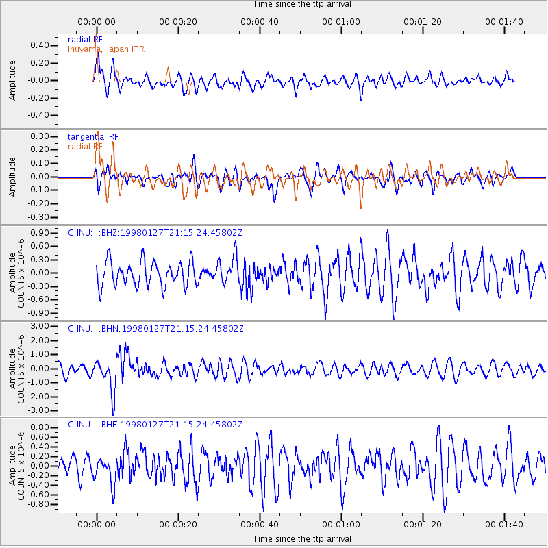
Signal To Noise
| Channel | StoN | STA | LTA |
| G:INU: :BHN:19980127T21:15:24.45802Z | 3.401069 | 1.1719032E-6 | 3.4456912E-7 |
| G:INU: :BHE:19980127T21:15:24.45802Z | 1.3800312 | 2.944789E-7 | 2.1338568E-7 |
| G:INU: :BHZ:19980127T21:15:24.45802Z | 1.1158756 | 3.011682E-7 | 2.6989406E-7 |
| Arrivals |
| Ps | |
| PpPs | |
| PsPs/PpSs | |


