You are here: Home > Network List > G - GEOSCOPE Stations List
> Station INU Inuyama, Japan > Earthquake Result Viewer
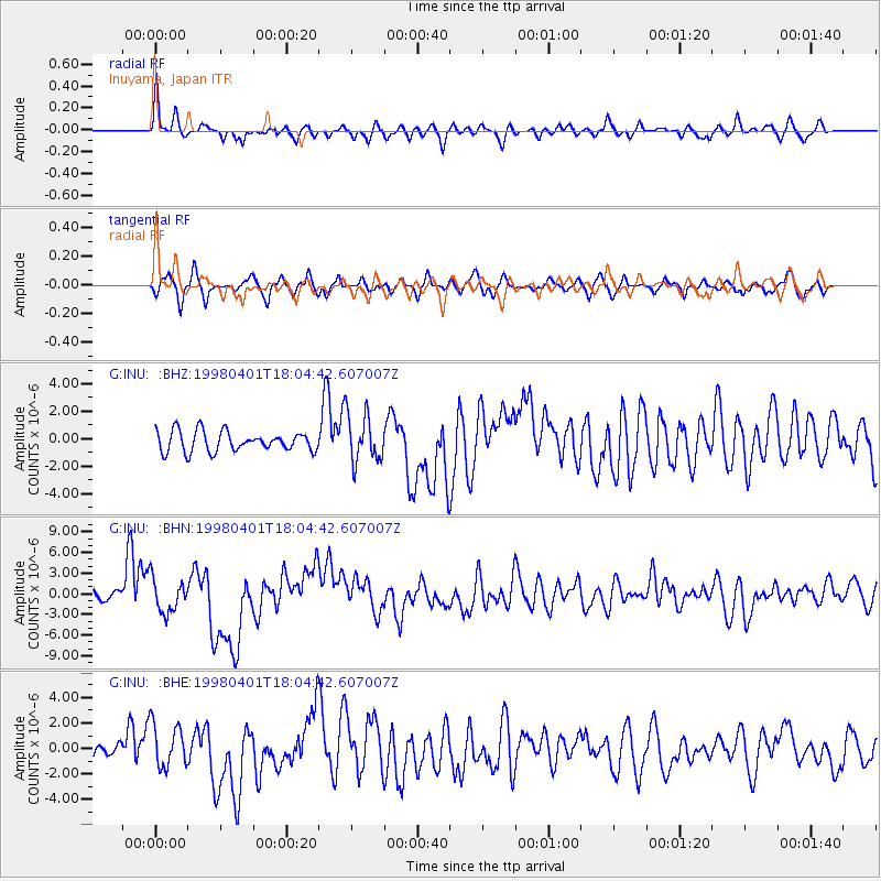
INU Inuyama, Japan - Earthquake Result Viewer
*The percent match for this event was below the threshold and hence no stack was calculated.
| Earthquake location: |
Southern Sumatra, Indonesia |
| Earthquake latitude/longitude: |
-0.5/99.3 |
| Earthquake time(UTC): |
1998/04/01 (091) 17:56:23 GMT |
| Earthquake Depth: |
56 km |
| Earthquake Magnitude: |
6.2 MB, 6.9 MS, 7.0 UNKNOWN, 6.6 ME |
| Earthquake Catalog/Contributor: |
WHDF/NEIC |
|
| Network: |
G GEOSCOPE |
| Station: |
INU Inuyama, Japan |
| Lat/Lon: |
35.35 N/137.03 E |
| Elevation: |
132 m |
|
| Distance: |
50.2 deg |
| Az: |
40.701 deg |
| Baz: |
232.911 deg |
| Ray Param: |
$rayparam |
*The percent match for this event was below the threshold and hence was not used in the summary stack. |
|
| Radial Match: |
64.08074 % |
| Radial Bump: |
400 |
| Transverse Match: |
52.13156 % |
| Transverse Bump: |
365 |
| SOD ConfigId: |
4480 |
| Insert Time: |
2010-02-26 23:27:14.470 +0000 |
| GWidth: |
2.5 |
| Max Bumps: |
400 |
| Tol: |
0.001 |
|
Signal To Noise
| Channel | StoN | STA | LTA |
| G:INU: :BHN:19980401T18:04:42.607007Z | 2.8031442 | 2.4271458E-6 | 8.6586545E-7 |
| G:INU: :BHE:19980401T18:04:42.607007Z | 2.265045 | 1.7289134E-6 | 7.6330195E-7 |
| G:INU: :BHZ:19980401T18:04:42.607007Z | 2.3636522 | 1.745908E-6 | 7.386484E-7 |
| Arrivals |
| Ps | |
| PpPs | |
| PsPs/PpSs | |


