You are here: Home > Network List > G - GEOSCOPE Stations List
> Station INU Inuyama, Japan > Earthquake Result Viewer
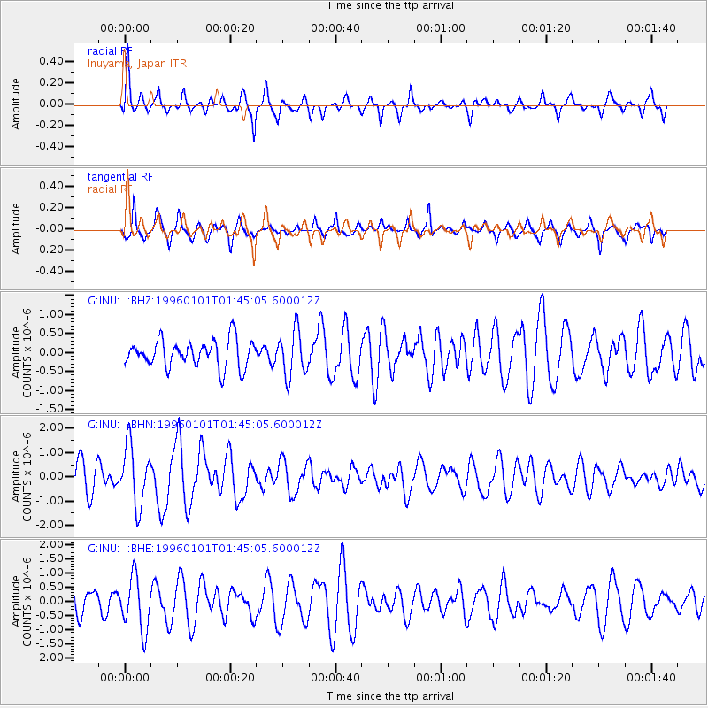
INU Inuyama, Japan - Earthquake Result Viewer
*The percent match for this event was below the threshold and hence no stack was calculated.
| Earthquake location: |
Tonga Islands |
| Earthquake latitude/longitude: |
-20.3/-174.4 |
| Earthquake time(UTC): |
1996/01/01 (001) 01:34:15 GMT |
| Earthquake Depth: |
33 km |
| Earthquake Magnitude: |
5.8 MS, 5.3 MB |
| Earthquake Catalog/Contributor: |
WHDF/NEIC |
|
| Network: |
G GEOSCOPE |
| Station: |
INU Inuyama, Japan |
| Lat/Lon: |
35.35 N/137.03 E |
| Elevation: |
132 m |
|
| Distance: |
72.0 deg |
| Az: |
319.854 deg |
| Baz: |
132.25 deg |
| Ray Param: |
$rayparam |
*The percent match for this event was below the threshold and hence was not used in the summary stack. |
|
| Radial Match: |
63.63749 % |
| Radial Bump: |
364 |
| Transverse Match: |
70.96177 % |
| Transverse Bump: |
290 |
| SOD ConfigId: |
4480 |
| Insert Time: |
2010-02-26 23:27:15.351 +0000 |
| GWidth: |
2.5 |
| Max Bumps: |
400 |
| Tol: |
0.001 |
|
Signal To Noise
| Channel | StoN | STA | LTA |
| G:INU: :BHN:19960101T01:45:05.600012Z | 1.9493126 | 1.2438147E-6 | 6.380787E-7 |
| G:INU: :BHE:19960101T01:45:05.600012Z | 1.4715267 | 9.3901104E-7 | 6.3812024E-7 |
| G:INU: :BHZ:19960101T01:45:05.600012Z | 1.6854005 | 6.028805E-7 | 3.5770756E-7 |
| Arrivals |
| Ps | |
| PpPs | |
| PsPs/PpSs | |


