You are here: Home > Network List > TA - USArray Transportable Network (new EarthScope stations) Stations List
> Station T40A Mansfield, MO, USA > Earthquake Result Viewer
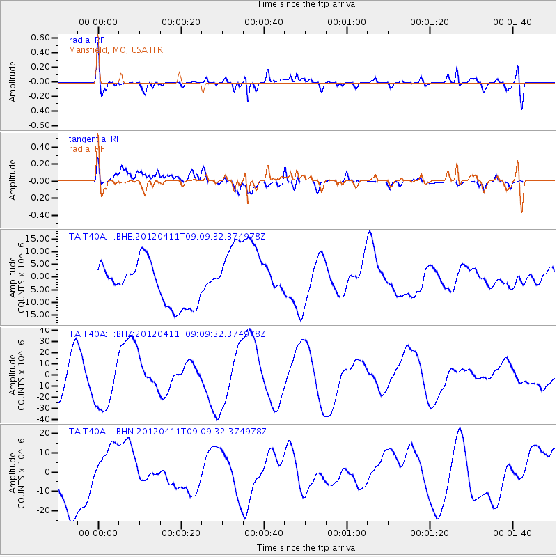
T40A Mansfield, MO, USA - Earthquake Result Viewer
*The percent match for this event was below the threshold and hence no stack was calculated.
| Earthquake location: |
Andreanof Islands, Aleutian Is. |
| Earthquake latitude/longitude: |
51.4/-176.1 |
| Earthquake time(UTC): |
2012/04/11 (102) 09:00:09 GMT |
| Earthquake Depth: |
21 km |
| Earthquake Magnitude: |
5.5 MB, 5.4 ML |
| Earthquake Catalog/Contributor: |
WHDF/NEIC |
|
| Network: |
TA USArray Transportable Network (new EarthScope stations) |
| Station: |
T40A Mansfield, MO, USA |
| Lat/Lon: |
37.15 N/92.52 W |
| Elevation: |
399 m |
|
| Distance: |
58.4 deg |
| Az: |
68.838 deg |
| Baz: |
312.969 deg |
| Ray Param: |
$rayparam |
*The percent match for this event was below the threshold and hence was not used in the summary stack. |
|
| Radial Match: |
60.222317 % |
| Radial Bump: |
400 |
| Transverse Match: |
42.120655 % |
| Transverse Bump: |
400 |
| SOD ConfigId: |
446234 |
| Insert Time: |
2012-07-04 09:48:35.215 +0000 |
| GWidth: |
2.5 |
| Max Bumps: |
400 |
| Tol: |
0.001 |
|
Signal To Noise
| Channel | StoN | STA | LTA |
| TA:T40A: :BHZ:20120411T09:09:32.374978Z | 1.9670372 | 2.5869977E-5 | 1.3151747E-5 |
| TA:T40A: :BHN:20120411T09:09:32.374978Z | 1.0092434 | 1.2452111E-5 | 1.2338066E-5 |
| TA:T40A: :BHE:20120411T09:09:32.374978Z | 1.7154666 | 1.3905032E-5 | 8.105685E-6 |
| Arrivals |
| Ps | |
| PpPs | |
| PsPs/PpSs | |


