You are here: Home > Network List > TA - USArray Transportable Network (new EarthScope stations) Stations List
> Station R42A Luebbering, MO, USA > Earthquake Result Viewer
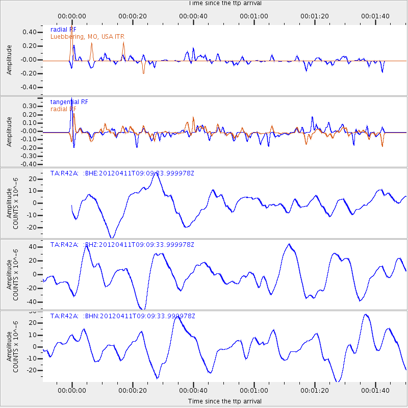
R42A Luebbering, MO, USA - Earthquake Result Viewer
*The percent match for this event was below the threshold and hence no stack was calculated.
| Earthquake location: |
Andreanof Islands, Aleutian Is. |
| Earthquake latitude/longitude: |
51.4/-176.1 |
| Earthquake time(UTC): |
2012/04/11 (102) 09:00:09 GMT |
| Earthquake Depth: |
21 km |
| Earthquake Magnitude: |
5.5 MB, 5.4 ML |
| Earthquake Catalog/Contributor: |
WHDF/NEIC |
|
| Network: |
TA USArray Transportable Network (new EarthScope stations) |
| Station: |
R42A Luebbering, MO, USA |
| Lat/Lon: |
38.28 N/90.79 W |
| Elevation: |
218 m |
|
| Distance: |
58.6 deg |
| Az: |
66.776 deg |
| Baz: |
312.941 deg |
| Ray Param: |
$rayparam |
*The percent match for this event was below the threshold and hence was not used in the summary stack. |
|
| Radial Match: |
51.153397 % |
| Radial Bump: |
400 |
| Transverse Match: |
58.69881 % |
| Transverse Bump: |
400 |
| SOD ConfigId: |
446234 |
| Insert Time: |
2012-07-04 09:51:23.929 +0000 |
| GWidth: |
2.5 |
| Max Bumps: |
400 |
| Tol: |
0.001 |
|
Signal To Noise
| Channel | StoN | STA | LTA |
| TA:R42A: :BHZ:20120411T09:09:33.999978Z | 2.168232 | 2.5842217E-5 | 1.1918567E-5 |
| TA:R42A: :BHN:20120411T09:09:33.999978Z | 2.906238 | 1.2717196E-5 | 4.3758273E-6 |
| TA:R42A: :BHE:20120411T09:09:33.999978Z | 0.935962 | 1.13479455E-5 | 1.2124365E-5 |
| Arrivals |
| Ps | |
| PpPs | |
| PsPs/PpSs | |


