You are here: Home > Network List > TA - USArray Transportable Network (new EarthScope stations) Stations List
> Station R41A Rosebud, MO, USA > Earthquake Result Viewer
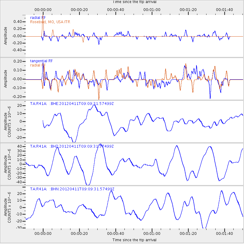
R41A Rosebud, MO, USA - Earthquake Result Viewer
*The percent match for this event was below the threshold and hence no stack was calculated.
| Earthquake location: |
Andreanof Islands, Aleutian Is. |
| Earthquake latitude/longitude: |
51.4/-176.1 |
| Earthquake time(UTC): |
2012/04/11 (102) 09:00:09 GMT |
| Earthquake Depth: |
21 km |
| Earthquake Magnitude: |
5.5 MB, 5.4 ML |
| Earthquake Catalog/Contributor: |
WHDF/NEIC |
|
| Network: |
TA USArray Transportable Network (new EarthScope stations) |
| Station: |
R41A Rosebud, MO, USA |
| Lat/Lon: |
38.30 N/91.38 W |
| Elevation: |
257 m |
|
| Distance: |
58.2 deg |
| Az: |
67.129 deg |
| Baz: |
312.765 deg |
| Ray Param: |
$rayparam |
*The percent match for this event was below the threshold and hence was not used in the summary stack. |
|
| Radial Match: |
63.802437 % |
| Radial Bump: |
400 |
| Transverse Match: |
71.10851 % |
| Transverse Bump: |
400 |
| SOD ConfigId: |
446234 |
| Insert Time: |
2012-07-04 09:51:34.227 +0000 |
| GWidth: |
2.5 |
| Max Bumps: |
400 |
| Tol: |
0.001 |
|
Signal To Noise
| Channel | StoN | STA | LTA |
| TA:R41A: :BHZ:20120411T09:09:31.57499Z | 1.1055053 | 1.6120754E-5 | 1.458225E-5 |
| TA:R41A: :BHN:20120411T09:09:31.57499Z | 1.6372637 | 1.1681034E-5 | 7.134486E-6 |
| TA:R41A: :BHE:20120411T09:09:31.57499Z | 1.5592788 | 1.6854852E-5 | 1.0809389E-5 |
| Arrivals |
| Ps | |
| PpPs | |
| PsPs/PpSs | |


