You are here: Home > Network List > TA - USArray Transportable Network (new EarthScope stations) Stations List
> Station H43A Windswept, Luxemburg, WI, USA > Earthquake Result Viewer
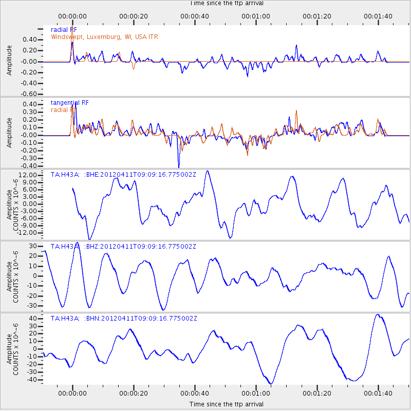
H43A Windswept, Luxemburg, WI, USA - Earthquake Result Viewer
*The percent match for this event was below the threshold and hence no stack was calculated.
| Earthquake location: |
Andreanof Islands, Aleutian Is. |
| Earthquake latitude/longitude: |
51.4/-176.1 |
| Earthquake time(UTC): |
2012/04/11 (102) 09:00:09 GMT |
| Earthquake Depth: |
21 km |
| Earthquake Magnitude: |
5.5 MB, 5.4 ML |
| Earthquake Catalog/Contributor: |
WHDF/NEIC |
|
| Network: |
TA USArray Transportable Network (new EarthScope stations) |
| Station: |
H43A Windswept, Luxemburg, WI, USA |
| Lat/Lon: |
44.47 N/87.77 W |
| Elevation: |
274 m |
|
| Distance: |
56.2 deg |
| Az: |
59.51 deg |
| Baz: |
311.014 deg |
| Ray Param: |
$rayparam |
*The percent match for this event was below the threshold and hence was not used in the summary stack. |
|
| Radial Match: |
32.50828 % |
| Radial Bump: |
400 |
| Transverse Match: |
34.4227 % |
| Transverse Bump: |
400 |
| SOD ConfigId: |
446234 |
| Insert Time: |
2012-07-04 09:52:53.014 +0000 |
| GWidth: |
2.5 |
| Max Bumps: |
400 |
| Tol: |
0.001 |
|
Signal To Noise
| Channel | StoN | STA | LTA |
| TA:H43A: :BHZ:20120411T09:09:16.775002Z | 1.9458115 | 2.1036583E-5 | 1.08112135E-5 |
| TA:H43A: :BHN:20120411T09:09:16.775002Z | 1.0604417 | 1.3652485E-5 | 1.2874338E-5 |
| TA:H43A: :BHE:20120411T09:09:16.775002Z | 0.845054 | 6.227272E-6 | 7.369082E-6 |
| Arrivals |
| Ps | |
| PpPs | |
| PsPs/PpSs | |


