You are here: Home > Network List > TA - USArray Transportable Network (new EarthScope stations) Stations List
> Station Z46A Louisville, MS, USA > Earthquake Result Viewer
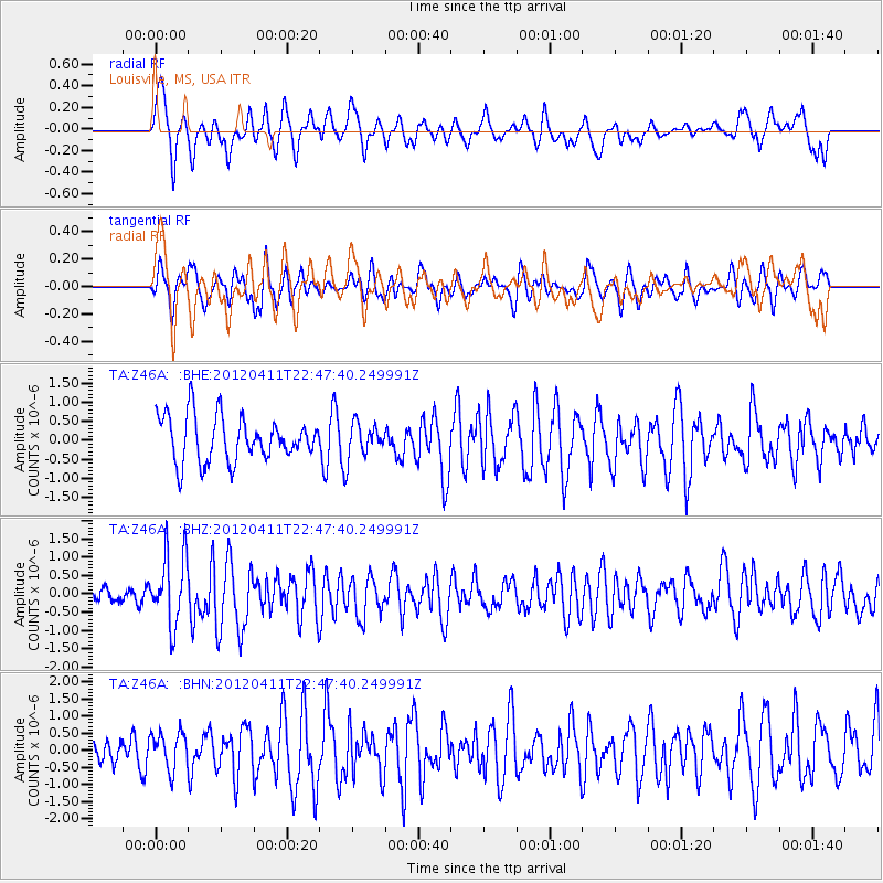
Z46A Louisville, MS, USA - Earthquake Result Viewer
*The percent match for this event was below the threshold and hence no stack was calculated.
| Earthquake location: |
Off Coast Of Oregon |
| Earthquake latitude/longitude: |
43.6/-127.6 |
| Earthquake time(UTC): |
2012/04/11 (102) 22:41:46 GMT |
| Earthquake Depth: |
8.0 km |
| Earthquake Magnitude: |
5.8 MB, 5.9 MS, 6.0 MW |
| Earthquake Catalog/Contributor: |
WHDF/NEIC |
|
| Network: |
TA USArray Transportable Network (new EarthScope stations) |
| Station: |
Z46A Louisville, MS, USA |
| Lat/Lon: |
33.19 N/88.94 W |
| Elevation: |
125 m |
|
| Distance: |
31.8 deg |
| Az: |
95.84 deg |
| Baz: |
300.444 deg |
| Ray Param: |
$rayparam |
*The percent match for this event was below the threshold and hence was not used in the summary stack. |
|
| Radial Match: |
71.22779 % |
| Radial Bump: |
400 |
| Transverse Match: |
49.44723 % |
| Transverse Bump: |
400 |
| SOD ConfigId: |
446234 |
| Insert Time: |
2012-07-04 10:41:27.942 +0000 |
| GWidth: |
2.5 |
| Max Bumps: |
400 |
| Tol: |
0.001 |
|
Signal To Noise
| Channel | StoN | STA | LTA |
| TA:Z46A: :BHZ:20120411T22:47:40.249991Z | 3.6703155 | 9.694204E-7 | 2.641245E-7 |
| TA:Z46A: :BHN:20120411T22:47:40.249991Z | 0.79798275 | 5.5515955E-7 | 6.957037E-7 |
| TA:Z46A: :BHE:20120411T22:47:40.249991Z | 0.72118664 | 4.2367512E-7 | 5.8746946E-7 |
| Arrivals |
| Ps | |
| PpPs | |
| PsPs/PpSs | |


