You are here: Home > Network List > TA - USArray Transportable Network (new EarthScope stations) Stations List
> Station X44A Crenshaw, MS, USA > Earthquake Result Viewer
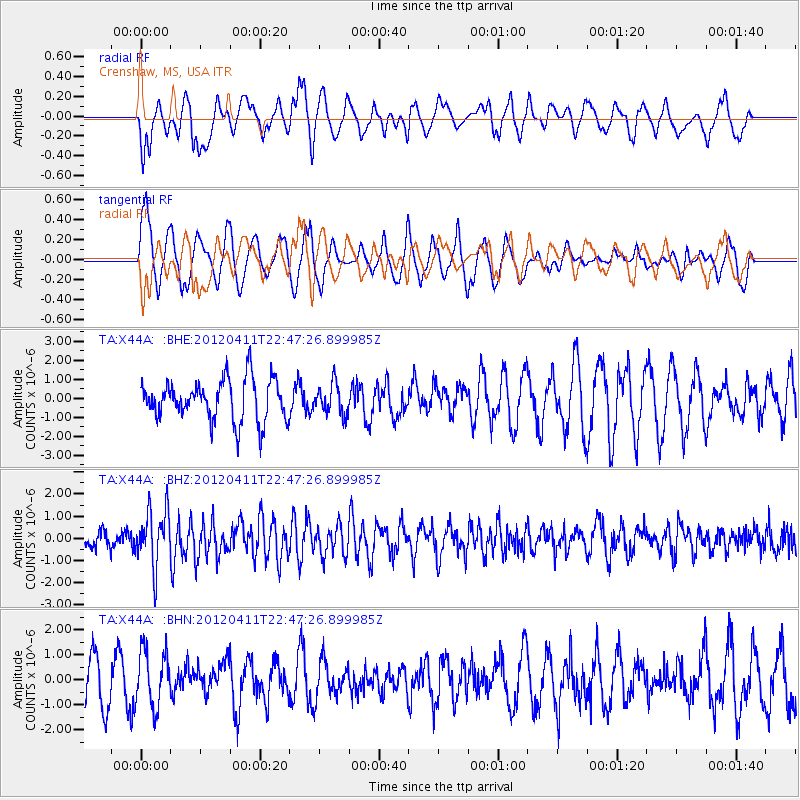
X44A Crenshaw, MS, USA - Earthquake Result Viewer
*The percent match for this event was below the threshold and hence no stack was calculated.
| Earthquake location: |
Off Coast Of Oregon |
| Earthquake latitude/longitude: |
43.6/-127.6 |
| Earthquake time(UTC): |
2012/04/11 (102) 22:41:46 GMT |
| Earthquake Depth: |
8.0 km |
| Earthquake Magnitude: |
5.8 MB, 5.9 MS, 6.0 MW |
| Earthquake Catalog/Contributor: |
WHDF/NEIC |
|
| Network: |
TA USArray Transportable Network (new EarthScope stations) |
| Station: |
X44A Crenshaw, MS, USA |
| Lat/Lon: |
34.50 N/90.15 W |
| Elevation: |
109 m |
|
| Distance: |
30.3 deg |
| Az: |
94.603 deg |
| Baz: |
298.715 deg |
| Ray Param: |
$rayparam |
*The percent match for this event was below the threshold and hence was not used in the summary stack. |
|
| Radial Match: |
64.13644 % |
| Radial Bump: |
400 |
| Transverse Match: |
63.355858 % |
| Transverse Bump: |
375 |
| SOD ConfigId: |
446234 |
| Insert Time: |
2012-07-04 10:41:41.846 +0000 |
| GWidth: |
2.5 |
| Max Bumps: |
400 |
| Tol: |
0.001 |
|
Signal To Noise
| Channel | StoN | STA | LTA |
| TA:X44A: :BHZ:20120411T22:47:26.899985Z | 3.8690164 | 1.2681968E-6 | 3.2778271E-7 |
| TA:X44A: :BHN:20120411T22:47:26.899985Z | 1.3040444 | 1.1236311E-6 | 8.61651E-7 |
| TA:X44A: :BHE:20120411T22:47:26.899985Z | 0.74284095 | 8.0755035E-7 | 1.0871107E-6 |
| Arrivals |
| Ps | |
| PpPs | |
| PsPs/PpSs | |


