You are here: Home > Network List > TA - USArray Transportable Network (new EarthScope stations) Stations List
> Station O47A Sheridan, IN, USA > Earthquake Result Viewer
O47A Sheridan, IN, USA - Earthquake Result Viewer

| Earthquake location: |
Off Coast Of Oregon |
| Earthquake latitude/longitude: |
43.6/-127.6 |
| Earthquake time(UTC): |
2012/04/11 (102) 22:41:46 GMT |
| Earthquake Depth: |
8.0 km |
| Earthquake Magnitude: |
5.8 MB, 5.9 MS, 6.0 MW |
| Earthquake Catalog/Contributor: |
WHDF/NEIC |
|
| Network: |
TA USArray Transportable Network (new EarthScope stations) |
| Station: |
O47A Sheridan, IN, USA |
| Lat/Lon: |
40.24 N/86.17 W |
| Elevation: |
278 m |
|
| Distance: |
30.8 deg |
| Az: |
81.755 deg |
| Baz: |
290.043 deg |
| Ray Param: |
0.07923697 |
| Estimated Moho Depth: |
52.75 km |
| Estimated Crust Vp/Vs: |
1.60 |
| Assumed Crust Vp: |
6.498 km/s |
| Estimated Crust Vs: |
4.061 km/s |
| Estimated Crust Poisson's Ratio: |
0.18 |
|
| Radial Match: |
84.49607 % |
| Radial Bump: |
372 |
| Transverse Match: |
64.87658 % |
| Transverse Bump: |
400 |
| SOD ConfigId: |
446234 |
| Insert Time: |
2012-07-04 10:42:30.942 +0000 |
| GWidth: |
2.5 |
| Max Bumps: |
400 |
| Tol: |
0.001 |
|
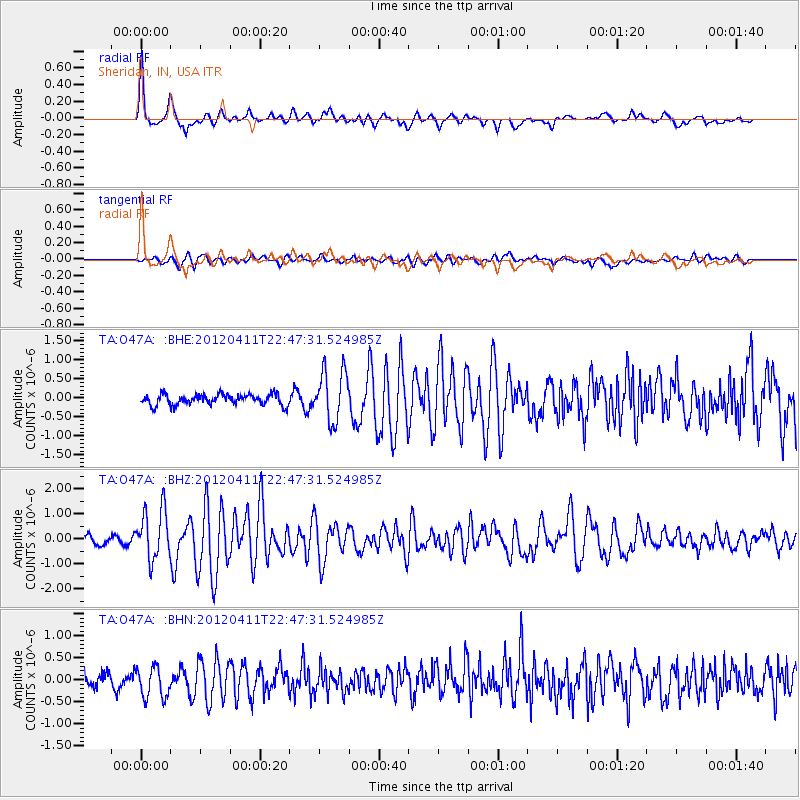
Signal To Noise
| Channel | StoN | STA | LTA |
| TA:O47A: :BHZ:20120411T22:47:31.524985Z | 5.8469596 | 9.953276E-7 | 1.7022994E-7 |
| TA:O47A: :BHN:20120411T22:47:31.524985Z | 2.1944246 | 3.5185843E-7 | 1.60342E-7 |
| TA:O47A: :BHE:20120411T22:47:31.524985Z | 4.7677317 | 6.6966516E-7 | 1.4045781E-7 |
| Arrivals |
| Ps | 5.3 SECOND |
| PpPs | 19 SECOND |
| PsPs/PpSs | 25 SECOND |


