You are here: Home > Network List > US - United States National Seismic Network Stations List
> Station AMTX Amarillo, Texas, USA > Earthquake Result Viewer
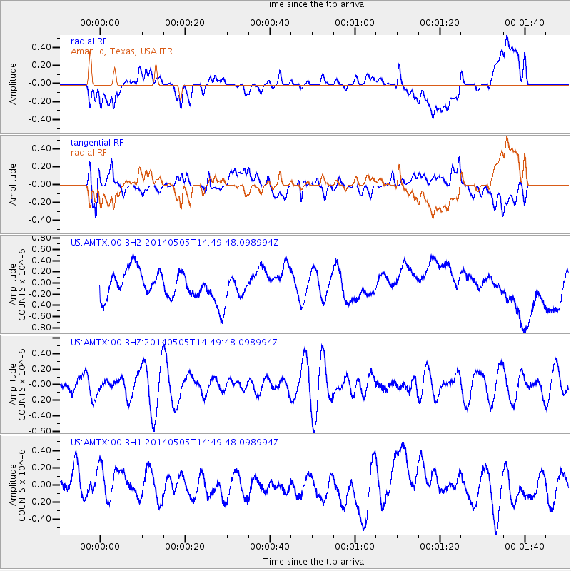
AMTX Amarillo, Texas, USA - Earthquake Result Viewer
*The percent match for this event was below the threshold and hence no stack was calculated.
| Earthquake location: |
Kuril Islands |
| Earthquake latitude/longitude: |
44.4/148.4 |
| Earthquake time(UTC): |
2014/05/05 (125) 14:38:25 GMT |
| Earthquake Depth: |
82 km |
| Earthquake Magnitude: |
4.2 mb |
| Earthquake Catalog/Contributor: |
ISC/ISC |
|
| Network: |
US United States National Seismic Network |
| Station: |
AMTX Amarillo, Texas, USA |
| Lat/Lon: |
34.53 N/101.41 W |
| Elevation: |
1010 m |
|
| Distance: |
79.1 deg |
| Az: |
52.095 deg |
| Baz: |
316.757 deg |
| Ray Param: |
$rayparam |
*The percent match for this event was below the threshold and hence was not used in the summary stack. |
|
| Radial Match: |
22.389002 % |
| Radial Bump: |
400 |
| Transverse Match: |
38.639084 % |
| Transverse Bump: |
400 |
| SOD ConfigId: |
3390531 |
| Insert Time: |
2019-04-11 17:51:48.441 +0000 |
| GWidth: |
2.5 |
| Max Bumps: |
400 |
| Tol: |
0.001 |
|
Signal To Noise
| Channel | StoN | STA | LTA |
| US:AMTX:00:BHZ:20140505T14:49:48.098994Z | 0.2849542 | 7.046693E-8 | 2.4729215E-7 |
| US:AMTX:00:BH1:20140505T14:49:48.098994Z | 1.573226 | 2.0348337E-7 | 1.2934147E-7 |
| US:AMTX:00:BH2:20140505T14:49:48.098994Z | 0.7335896 | 1.495258E-7 | 2.038276E-7 |
| Arrivals |
| Ps | |
| PpPs | |
| PsPs/PpSs | |


