You are here: Home > Network List > TA - USArray Transportable Network (new EarthScope stations) Stations List
> Station W47A Westpoint, TN, USA > Earthquake Result Viewer
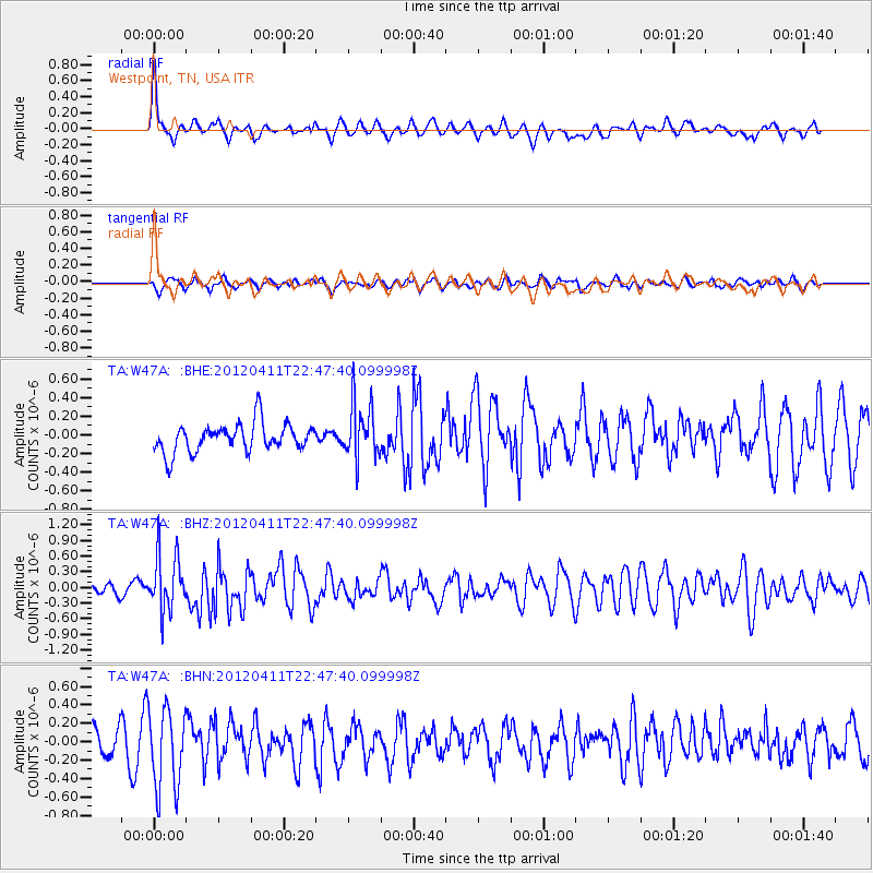
W47A Westpoint, TN, USA - Earthquake Result Viewer
*The percent match for this event was below the threshold and hence no stack was calculated.
| Earthquake location: |
Off Coast Of Oregon |
| Earthquake latitude/longitude: |
43.6/-127.6 |
| Earthquake time(UTC): |
2012/04/11 (102) 22:41:46 GMT |
| Earthquake Depth: |
8.0 km |
| Earthquake Magnitude: |
5.8 MB, 5.9 MS, 6.0 MW |
| Earthquake Catalog/Contributor: |
WHDF/NEIC |
|
| Network: |
TA USArray Transportable Network (new EarthScope stations) |
| Station: |
W47A Westpoint, TN, USA |
| Lat/Lon: |
35.25 N/87.59 W |
| Elevation: |
293 m |
|
| Distance: |
31.8 deg |
| Az: |
91.405 deg |
| Baz: |
297.427 deg |
| Ray Param: |
$rayparam |
*The percent match for this event was below the threshold and hence was not used in the summary stack. |
|
| Radial Match: |
65.778465 % |
| Radial Bump: |
400 |
| Transverse Match: |
50.378643 % |
| Transverse Bump: |
400 |
| SOD ConfigId: |
446234 |
| Insert Time: |
2012-07-04 10:46:19.155 +0000 |
| GWidth: |
2.5 |
| Max Bumps: |
400 |
| Tol: |
0.001 |
|
Signal To Noise
| Channel | StoN | STA | LTA |
| TA:W47A: :BHZ:20120411T22:47:40.099998Z | 3.3863735 | 5.3078E-7 | 1.5673996E-7 |
| TA:W47A: :BHN:20120411T22:47:40.099998Z | 3.1297498 | 4.3829402E-7 | 1.4004124E-7 |
| TA:W47A: :BHE:20120411T22:47:40.099998Z | 1.9468685 | 2.9890202E-7 | 1.5352964E-7 |
| Arrivals |
| Ps | |
| PpPs | |
| PsPs/PpSs | |


