You are here: Home > Network List > G - GEOSCOPE Stations List
> Station INU Inuyama, Japan > Earthquake Result Viewer
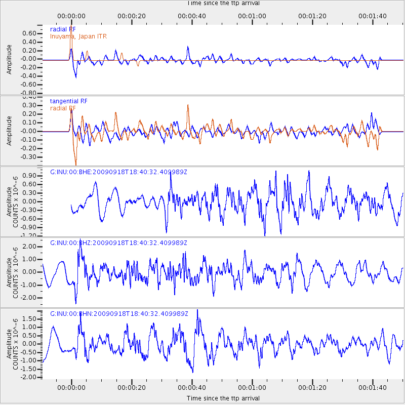
INU Inuyama, Japan - Earthquake Result Viewer
*The percent match for this event was below the threshold and hence no stack was calculated.
| Earthquake location: |
Halmahera, Indonesia |
| Earthquake latitude/longitude: |
1.8/127.2 |
| Earthquake time(UTC): |
2009/09/18 (261) 18:34:22 GMT |
| Earthquake Depth: |
93 km |
| Earthquake Magnitude: |
5.7 MB, 5.8 MW, 5.8 MW |
| Earthquake Catalog/Contributor: |
WHDF/NEIC |
|
| Network: |
G GEOSCOPE |
| Station: |
INU Inuyama, Japan |
| Lat/Lon: |
35.35 N/137.03 E |
| Elevation: |
132 m |
|
| Distance: |
34.7 deg |
| Az: |
14.222 deg |
| Baz: |
197.481 deg |
| Ray Param: |
$rayparam |
*The percent match for this event was below the threshold and hence was not used in the summary stack. |
|
| Radial Match: |
71.498795 % |
| Radial Bump: |
400 |
| Transverse Match: |
68.0988 % |
| Transverse Bump: |
400 |
| SOD ConfigId: |
2622 |
| Insert Time: |
2010-02-26 23:27:53.121 +0000 |
| GWidth: |
2.5 |
| Max Bumps: |
400 |
| Tol: |
0.001 |
|
Signal To Noise
| Channel | StoN | STA | LTA |
| G:INU:00:BHZ:20090918T18:40:32.409989Z | 1.5915272 | 1.3065105E-6 | 8.209162E-7 |
| G:INU:00:BHN:20090918T18:40:32.409989Z | 0.8965505 | 6.863336E-7 | 7.65527E-7 |
| G:INU:00:BHE:20090918T18:40:32.409989Z | 1.436559 | 4.3344184E-7 | 3.0172228E-7 |
| Arrivals |
| Ps | |
| PpPs | |
| PsPs/PpSs | |


