You are here: Home > Network List > G - GEOSCOPE Stations List
> Station INU Inuyama, Japan > Earthquake Result Viewer
INU Inuyama, Japan - Earthquake Result Viewer
*The percent match for this event was below the threshold and hence no stack was calculated.
| Earthquake location: |
Myanmar |
| Earthquake latitude/longitude: |
20.4/94.8 |
| Earthquake time(UTC): |
2009/09/21 (264) 19:38:42 GMT |
| Earthquake Depth: |
84 km |
| Earthquake Magnitude: |
5.6 MB, 5.7 MW, 5.6 MW |
| Earthquake Catalog/Contributor: |
WHDF/NEIC |
|
| Network: |
G GEOSCOPE |
| Station: |
INU Inuyama, Japan |
| Lat/Lon: |
35.35 N/137.03 E |
| Elevation: |
132 m |
|
| Distance: |
39.9 deg |
| Az: |
58.973 deg |
| Baz: |
259.514 deg |
| Ray Param: |
$rayparam |
*The percent match for this event was below the threshold and hence was not used in the summary stack. |
|
| Radial Match: |
49.630222 % |
| Radial Bump: |
400 |
| Transverse Match: |
53.57073 % |
| Transverse Bump: |
400 |
| SOD ConfigId: |
2622 |
| Insert Time: |
2010-02-26 23:27:54.599 +0000 |
| GWidth: |
2.5 |
| Max Bumps: |
400 |
| Tol: |
0.001 |
|
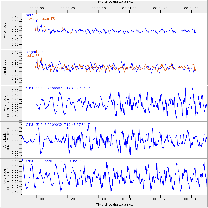
Signal To Noise
| Channel | StoN | STA | LTA |
| G:INU:00:BHZ:20090921T19:45:37.511Z | 3.979728 | 6.723366E-7 | 1.6894035E-7 |
| G:INU:00:BHN:20090921T19:45:37.511Z | 0.6883269 | 1.7198091E-7 | 2.4985354E-7 |
| G:INU:00:BHE:20090921T19:45:37.511Z | 0.6039833 | 1.504284E-7 | 2.4906055E-7 |
| Arrivals |
| Ps | |
| PpPs | |
| PsPs/PpSs | |


