You are here: Home > Network List > G - GEOSCOPE Stations List
> Station INU Inuyama, Japan > Earthquake Result Viewer
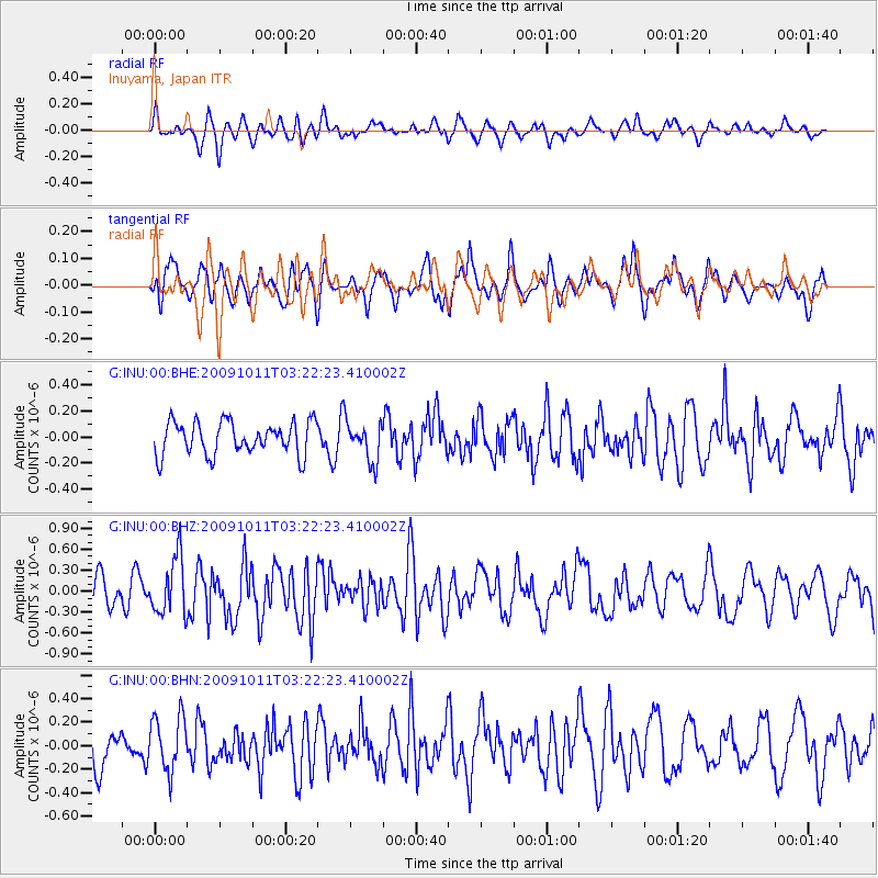
INU Inuyama, Japan - Earthquake Result Viewer
*The percent match for this event was below the threshold and hence no stack was calculated.
| Earthquake location: |
Southeast Of Loyalty Islands |
| Earthquake latitude/longitude: |
-22.0/170.2 |
| Earthquake time(UTC): |
2009/10/11 (284) 03:12:13 GMT |
| Earthquake Depth: |
10 km |
| Earthquake Magnitude: |
5.7 MB, 5.5 MS, 6.0 MW, 5.9 MW |
| Earthquake Catalog/Contributor: |
WHDF/NEIC |
|
| Network: |
G GEOSCOPE |
| Station: |
INU Inuyama, Japan |
| Lat/Lon: |
35.35 N/137.03 E |
| Elevation: |
132 m |
|
| Distance: |
65.2 deg |
| Az: |
330.428 deg |
| Baz: |
145.925 deg |
| Ray Param: |
$rayparam |
*The percent match for this event was below the threshold and hence was not used in the summary stack. |
|
| Radial Match: |
55.221035 % |
| Radial Bump: |
400 |
| Transverse Match: |
54.90527 % |
| Transverse Bump: |
400 |
| SOD ConfigId: |
2622 |
| Insert Time: |
2010-02-26 23:27:58.591 +0000 |
| GWidth: |
2.5 |
| Max Bumps: |
400 |
| Tol: |
0.001 |
|
Signal To Noise
| Channel | StoN | STA | LTA |
| G:INU:00:BHZ:20091011T03:22:23.410002Z | 2.1566486 | 4.107689E-7 | 1.9046631E-7 |
| G:INU:00:BHN:20091011T03:22:23.410002Z | 1.259062 | 2.3532098E-7 | 1.8690183E-7 |
| G:INU:00:BHE:20091011T03:22:23.410002Z | 1.2042915 | 1.5231872E-7 | 1.2647995E-7 |
| Arrivals |
| Ps | |
| PpPs | |
| PsPs/PpSs | |


