You are here: Home > Network List > TA - USArray Transportable Network (new EarthScope stations) Stations List
> Station 153A Fort Valley, GA, USA > Earthquake Result Viewer
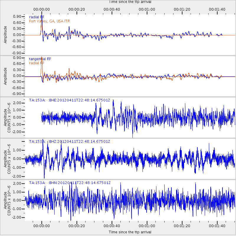
153A Fort Valley, GA, USA - Earthquake Result Viewer
*The percent match for this event was below the threshold and hence no stack was calculated.
| Earthquake location: |
Off Coast Of Oregon |
| Earthquake latitude/longitude: |
43.6/-127.6 |
| Earthquake time(UTC): |
2012/04/11 (102) 22:41:46 GMT |
| Earthquake Depth: |
8.0 km |
| Earthquake Magnitude: |
5.8 MB, 5.9 MS, 6.0 MW |
| Earthquake Catalog/Contributor: |
WHDF/NEIC |
|
| Network: |
TA USArray Transportable Network (new EarthScope stations) |
| Station: |
153A Fort Valley, GA, USA |
| Lat/Lon: |
32.66 N/83.83 W |
| Elevation: |
160 m |
|
| Distance: |
35.8 deg |
| Az: |
92.738 deg |
| Baz: |
300.629 deg |
| Ray Param: |
$rayparam |
*The percent match for this event was below the threshold and hence was not used in the summary stack. |
|
| Radial Match: |
71.625656 % |
| Radial Bump: |
400 |
| Transverse Match: |
55.897736 % |
| Transverse Bump: |
400 |
| SOD ConfigId: |
446234 |
| Insert Time: |
2012-07-04 10:49:31.563 +0000 |
| GWidth: |
2.5 |
| Max Bumps: |
400 |
| Tol: |
0.001 |
|
Signal To Noise
| Channel | StoN | STA | LTA |
| TA:153A: :BHZ:20120411T22:48:14.67501Z | 3.159319 | 9.54471E-7 | 3.021129E-7 |
| TA:153A: :BHN:20120411T22:48:14.67501Z | 1.4753927 | 6.496663E-7 | 4.4033447E-7 |
| TA:153A: :BHE:20120411T22:48:14.67501Z | 2.5021896 | 8.995482E-7 | 3.5950438E-7 |
| Arrivals |
| Ps | |
| PpPs | |
| PsPs/PpSs | |


