You are here: Home > Network List > TA - USArray Transportable Network (new EarthScope stations) Stations List
> Station 154A Montrose, GA, USA > Earthquake Result Viewer
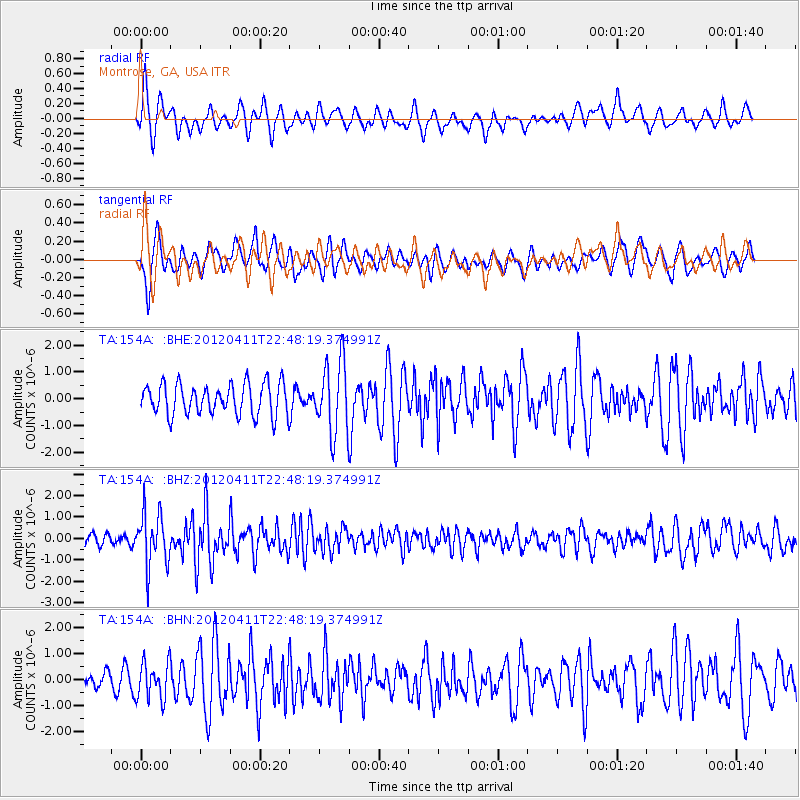
154A Montrose, GA, USA - Earthquake Result Viewer
*The percent match for this event was below the threshold and hence no stack was calculated.
| Earthquake location: |
Off Coast Of Oregon |
| Earthquake latitude/longitude: |
43.6/-127.6 |
| Earthquake time(UTC): |
2012/04/11 (102) 22:41:46 GMT |
| Earthquake Depth: |
8.0 km |
| Earthquake Magnitude: |
5.8 MB, 5.9 MS, 6.0 MW |
| Earthquake Catalog/Contributor: |
WHDF/NEIC |
|
| Network: |
TA USArray Transportable Network (new EarthScope stations) |
| Station: |
154A Montrose, GA, USA |
| Lat/Lon: |
32.61 N/83.11 W |
| Elevation: |
111 m |
|
| Distance: |
36.3 deg |
| Az: |
92.277 deg |
| Baz: |
300.645 deg |
| Ray Param: |
$rayparam |
*The percent match for this event was below the threshold and hence was not used in the summary stack. |
|
| Radial Match: |
59.4021 % |
| Radial Bump: |
397 |
| Transverse Match: |
67.10545 % |
| Transverse Bump: |
400 |
| SOD ConfigId: |
446234 |
| Insert Time: |
2012-07-04 10:49:32.849 +0000 |
| GWidth: |
2.5 |
| Max Bumps: |
400 |
| Tol: |
0.001 |
|
Signal To Noise
| Channel | StoN | STA | LTA |
| TA:154A: :BHZ:20120411T22:48:19.374991Z | 5.8827906 | 1.2269845E-6 | 2.0857186E-7 |
| TA:154A: :BHN:20120411T22:48:19.374991Z | 1.64647 | 7.078198E-7 | 4.2990146E-7 |
| TA:154A: :BHE:20120411T22:48:19.374991Z | 2.2950757 | 1.3375645E-6 | 5.8279755E-7 |
| Arrivals |
| Ps | |
| PpPs | |
| PsPs/PpSs | |


