You are here: Home > Network List > TA - USArray Transportable Network (new EarthScope stations) Stations List
> Station Z51A Franklin, GA, USA > Earthquake Result Viewer
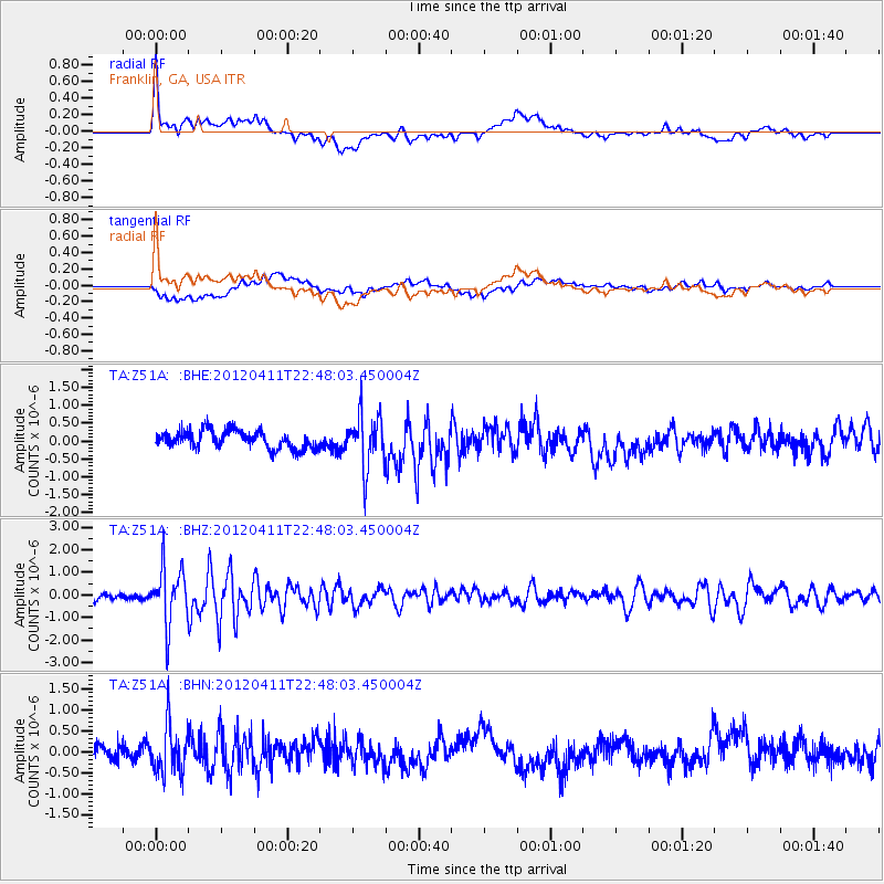
Z51A Franklin, GA, USA - Earthquake Result Viewer
*The percent match for this event was below the threshold and hence no stack was calculated.
| Earthquake location: |
Off Coast Of Oregon |
| Earthquake latitude/longitude: |
43.6/-127.6 |
| Earthquake time(UTC): |
2012/04/11 (102) 22:41:46 GMT |
| Earthquake Depth: |
8.0 km |
| Earthquake Magnitude: |
5.8 MB, 5.9 MS, 6.0 MW |
| Earthquake Catalog/Contributor: |
WHDF/NEIC |
|
| Network: |
TA USArray Transportable Network (new EarthScope stations) |
| Station: |
Z51A Franklin, GA, USA |
| Lat/Lon: |
33.32 N/85.17 W |
| Elevation: |
249 m |
|
| Distance: |
34.5 deg |
| Az: |
92.744 deg |
| Baz: |
299.906 deg |
| Ray Param: |
$rayparam |
*The percent match for this event was below the threshold and hence was not used in the summary stack. |
|
| Radial Match: |
68.326584 % |
| Radial Bump: |
400 |
| Transverse Match: |
56.846302 % |
| Transverse Bump: |
400 |
| SOD ConfigId: |
446234 |
| Insert Time: |
2012-07-04 10:49:59.762 +0000 |
| GWidth: |
2.5 |
| Max Bumps: |
400 |
| Tol: |
0.001 |
|
Signal To Noise
| Channel | StoN | STA | LTA |
| TA:Z51A: :BHZ:20120411T22:48:03.450004Z | 5.5577397 | 1.23515E-6 | 2.222396E-7 |
| TA:Z51A: :BHN:20120411T22:48:03.450004Z | 2.4453232 | 5.671527E-7 | 2.3193364E-7 |
| TA:Z51A: :BHE:20120411T22:48:03.450004Z | 3.056933 | 7.500357E-7 | 2.4535564E-7 |
| Arrivals |
| Ps | |
| PpPs | |
| PsPs/PpSs | |


