You are here: Home > Network List > GT - Global Telemetered Seismograph Network (USAF/USGS) Stations List
> Station LPAZ La Paz , Bolivia > Earthquake Result Viewer
LPAZ La Paz , Bolivia - Earthquake Result Viewer

| Earthquake location: |
Michoacan, Mexico |
| Earthquake latitude/longitude: |
18.2/-102.7 |
| Earthquake time(UTC): |
2012/04/11 (102) 22:55:10 GMT |
| Earthquake Depth: |
20 km |
| Earthquake Magnitude: |
5.8 MB, 6.7 MS, 6.5 MW, 6.7 MW |
| Earthquake Catalog/Contributor: |
WHDF/NEIC |
|
| Network: |
GT Global Telemetered Seismograph Network (USAF/USGS) |
| Station: |
LPAZ La Paz , Bolivia |
| Lat/Lon: |
16.17 S/68.08 W |
| Elevation: |
4817 m |
|
| Distance: |
48.3 deg |
| Az: |
133.001 deg |
| Baz: |
313.668 deg |
| Ray Param: |
0.06944253 |
| Estimated Moho Depth: |
34.0 km |
| Estimated Crust Vp/Vs: |
1.69 |
| Assumed Crust Vp: |
6.454 km/s |
| Estimated Crust Vs: |
3.83 km/s |
| Estimated Crust Poisson's Ratio: |
0.23 |
|
| Radial Match: |
88.98778 % |
| Radial Bump: |
400 |
| Transverse Match: |
68.7901 % |
| Transverse Bump: |
400 |
| SOD ConfigId: |
446234 |
| Insert Time: |
2012-07-04 10:58:45.700 +0000 |
| GWidth: |
2.5 |
| Max Bumps: |
400 |
| Tol: |
0.001 |
|
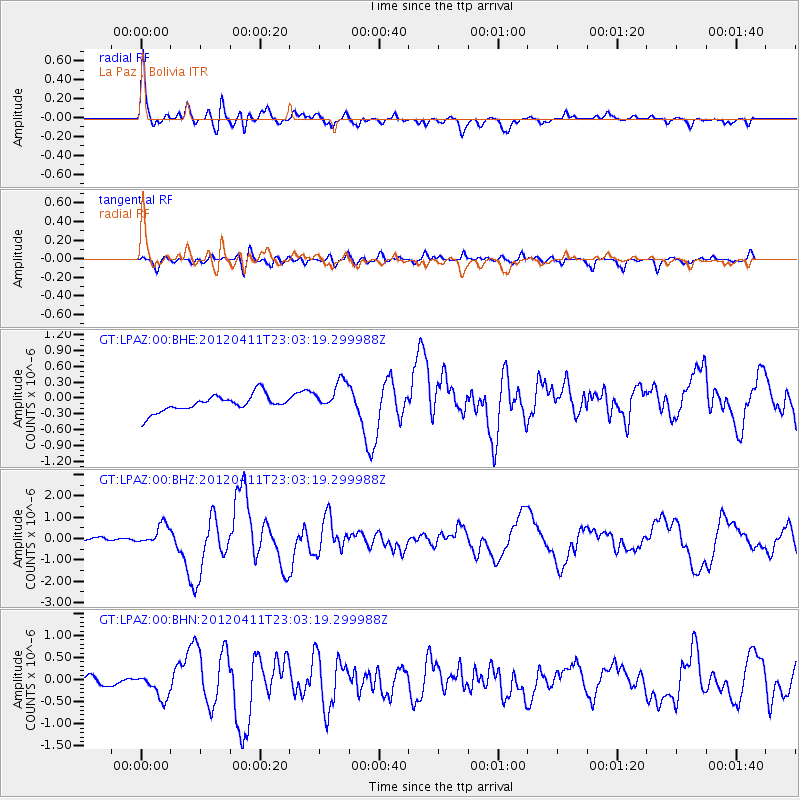
Signal To Noise
| Channel | StoN | STA | LTA |
| GT:LPAZ:00:BHZ:20120411T23:03:19.299988Z | 4.2525225 | 4.7269327E-7 | 1.1115597E-7 |
| GT:LPAZ:00:BHN:20120411T23:03:19.299988Z | 3.1781962 | 2.945004E-7 | 9.266276E-8 |
| GT:LPAZ:00:BHE:20120411T23:03:19.299988Z | 1.8150194 | 2.8821722E-7 | 1.5879567E-7 |
| Arrivals |
| Ps | 3.8 SECOND |
| PpPs | 13 SECOND |
| PsPs/PpSs | 17 SECOND |


