You are here: Home > Network List > G - GEOSCOPE Stations List
> Station INU Inuyama, Japan > Earthquake Result Viewer
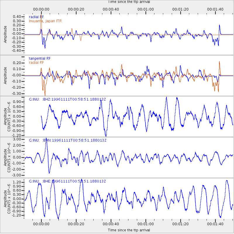
INU Inuyama, Japan - Earthquake Result Viewer
*The percent match for this event was below the threshold and hence no stack was calculated.
| Earthquake location: |
South Of Kermadec Islands |
| Earthquake latitude/longitude: |
-32.5/-179.0 |
| Earthquake time(UTC): |
1996/11/11 (316) 00:47:21 GMT |
| Earthquake Depth: |
33 km |
| Earthquake Magnitude: |
5.9 MB, 5.9 MS, 6.1 UNKNOWN, 6.0 MW |
| Earthquake Catalog/Contributor: |
WHDF/NEIC |
|
| Network: |
G GEOSCOPE |
| Station: |
INU Inuyama, Japan |
| Lat/Lon: |
35.35 N/137.03 E |
| Elevation: |
132 m |
|
| Distance: |
79.1 deg |
| Az: |
324.728 deg |
| Baz: |
143.367 deg |
| Ray Param: |
$rayparam |
*The percent match for this event was below the threshold and hence was not used in the summary stack. |
|
| Radial Match: |
51.802555 % |
| Radial Bump: |
400 |
| Transverse Match: |
54.454174 % |
| Transverse Bump: |
325 |
| SOD ConfigId: |
4480 |
| Insert Time: |
2010-02-26 23:28:25.426 +0000 |
| GWidth: |
2.5 |
| Max Bumps: |
400 |
| Tol: |
0.001 |
|
Signal To Noise
| Channel | StoN | STA | LTA |
| G:INU: :BHN:19961111T00:58:51.188013Z | 3.8840506 | 1.551714E-6 | 3.9950922E-7 |
| G:INU: :BHE:19961111T00:58:51.188013Z | 2.2745638 | 7.487488E-7 | 3.2918345E-7 |
| G:INU: :BHZ:19961111T00:58:51.188013Z | 1.2181057 | 4.3305582E-7 | 3.555158E-7 |
| Arrivals |
| Ps | |
| PpPs | |
| PsPs/PpSs | |


