You are here: Home > Network List > UW - Pacific Northwest Regional Seismic Network Stations List
> Station LEBA Lebam, WA, USA > Earthquake Result Viewer
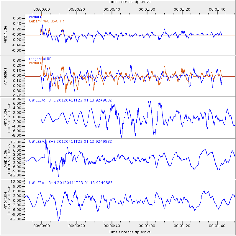
LEBA Lebam, WA, USA - Earthquake Result Viewer
*The percent match for this event was below the threshold and hence no stack was calculated.
| Earthquake location: |
Michoacan, Mexico |
| Earthquake latitude/longitude: |
18.2/-102.7 |
| Earthquake time(UTC): |
2012/04/11 (102) 22:55:10 GMT |
| Earthquake Depth: |
20 km |
| Earthquake Magnitude: |
5.8 MB, 6.7 MS, 6.5 MW, 6.7 MW |
| Earthquake Catalog/Contributor: |
WHDF/NEIC |
|
| Network: |
UW Pacific Northwest Regional Seismic Network |
| Station: |
LEBA Lebam, WA, USA |
| Lat/Lon: |
46.55 N/123.56 W |
| Elevation: |
73 m |
|
| Distance: |
33.1 deg |
| Az: |
333.218 deg |
| Baz: |
141.648 deg |
| Ray Param: |
$rayparam |
*The percent match for this event was below the threshold and hence was not used in the summary stack. |
|
| Radial Match: |
65.94569 % |
| Radial Bump: |
400 |
| Transverse Match: |
46.13369 % |
| Transverse Bump: |
400 |
| SOD ConfigId: |
446234 |
| Insert Time: |
2012-07-04 11:06:40.843 +0000 |
| GWidth: |
2.5 |
| Max Bumps: |
400 |
| Tol: |
0.001 |
|
Signal To Noise
| Channel | StoN | STA | LTA |
| UW:LEBA: :BHZ:20120411T23:01:13.924988Z | 3.3048134 | 5.580615E-6 | 1.6886323E-6 |
| UW:LEBA: :BHN:20120411T23:01:13.924988Z | 1.179623 | 2.5023303E-6 | 2.1212968E-6 |
| UW:LEBA: :BHE:20120411T23:01:13.924988Z | 1.8295574 | 2.8724735E-6 | 1.5700374E-6 |
| Arrivals |
| Ps | |
| PpPs | |
| PsPs/PpSs | |


