You are here: Home > Network List > CI - Caltech Regional Seismic Network Stations List
> Station LGU LGU, Camarillo, CA, USA > Earthquake Result Viewer
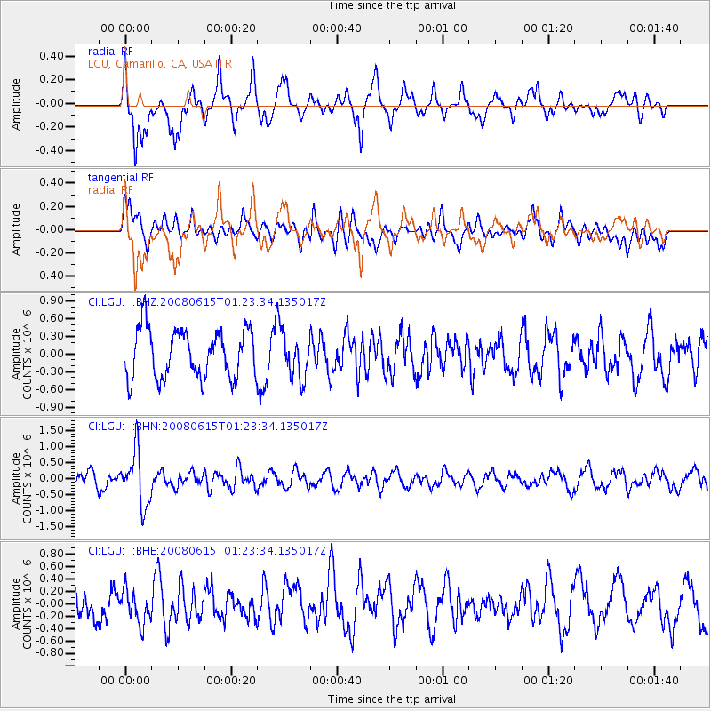
LGU LGU, Camarillo, CA, USA - Earthquake Result Viewer
*The percent match for this event was below the threshold and hence no stack was calculated.
| Earthquake location: |
Fiji Islands Region |
| Earthquake latitude/longitude: |
-17.7/-179.7 |
| Earthquake time(UTC): |
2008/06/15 (167) 01:13:11 GMT |
| Earthquake Depth: |
611 km |
| Earthquake Magnitude: |
5.5 MB, 5.9 MW, 5.9 MW |
| Earthquake Catalog/Contributor: |
WHDF/NEIC |
|
| Network: |
CI Caltech Regional Seismic Network |
| Station: |
LGU LGU, Camarillo, CA, USA |
| Lat/Lon: |
34.11 N/119.07 W |
| Elevation: |
416 m |
|
| Distance: |
77.4 deg |
| Az: |
47.837 deg |
| Baz: |
238.367 deg |
| Ray Param: |
$rayparam |
*The percent match for this event was below the threshold and hence was not used in the summary stack. |
|
| Radial Match: |
70.206215 % |
| Radial Bump: |
400 |
| Transverse Match: |
48.179977 % |
| Transverse Bump: |
400 |
| SOD ConfigId: |
2504 |
| Insert Time: |
2010-02-25 20:21:21.287 +0000 |
| GWidth: |
2.5 |
| Max Bumps: |
400 |
| Tol: |
0.001 |
|
Signal To Noise
| Channel | StoN | STA | LTA |
| CI:LGU: :BHN:20080615T01:23:34.135017Z | 3.5087144 | 8.418129E-7 | 2.399206E-7 |
| CI:LGU: :BHE:20080615T01:23:34.135017Z | 1.0598061 | 2.7459868E-7 | 2.5910276E-7 |
| CI:LGU: :BHZ:20080615T01:23:34.135017Z | 0.94576734 | 3.865486E-7 | 4.0871424E-7 |
| Arrivals |
| Ps | |
| PpPs | |
| PsPs/PpSs | |


