You are here: Home > Network List > G - GEOSCOPE Stations List
> Station INU Inuyama, Japan > Earthquake Result Viewer
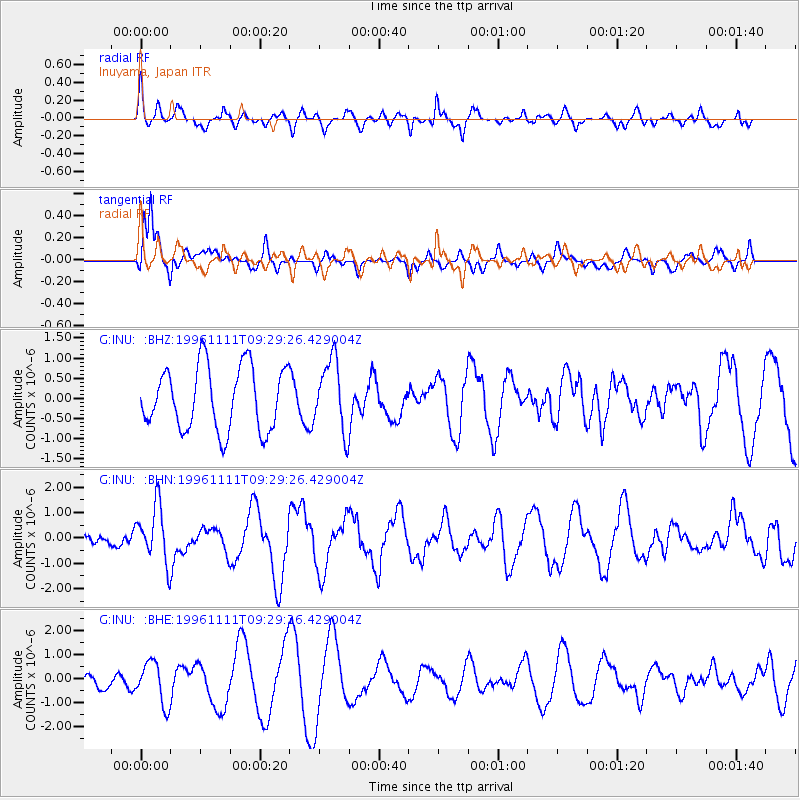
INU Inuyama, Japan - Earthquake Result Viewer
*The percent match for this event was below the threshold and hence no stack was calculated.
| Earthquake location: |
Myanmar |
| Earthquake latitude/longitude: |
19.3/95.0 |
| Earthquake time(UTC): |
1996/11/11 (316) 09:22:27 GMT |
| Earthquake Depth: |
80 km |
| Earthquake Magnitude: |
5.6 MB, 5.4 MS, 6.0 UNKNOWN, 5.9 MW |
| Earthquake Catalog/Contributor: |
WHDF/NEIC |
|
| Network: |
G GEOSCOPE |
| Station: |
INU Inuyama, Japan |
| Lat/Lon: |
35.35 N/137.03 E |
| Elevation: |
132 m |
|
| Distance: |
40.3 deg |
| Az: |
57.836 deg |
| Baz: |
257.932 deg |
| Ray Param: |
$rayparam |
*The percent match for this event was below the threshold and hence was not used in the summary stack. |
|
| Radial Match: |
46.88271 % |
| Radial Bump: |
390 |
| Transverse Match: |
78.11551 % |
| Transverse Bump: |
345 |
| SOD ConfigId: |
4480 |
| Insert Time: |
2010-02-26 23:28:26.123 +0000 |
| GWidth: |
2.5 |
| Max Bumps: |
400 |
| Tol: |
0.001 |
|
Signal To Noise
| Channel | StoN | STA | LTA |
| G:INU: :BHN:19961111T09:29:26.429004Z | 2.9641829 | 1.1136594E-6 | 3.7570538E-7 |
| G:INU: :BHE:19961111T09:29:26.429004Z | 3.7294612 | 8.815832E-7 | 2.3638353E-7 |
| G:INU: :BHZ:19961111T09:29:26.429004Z | 1.1288443 | 8.8690416E-7 | 7.856745E-7 |
| Arrivals |
| Ps | |
| PpPs | |
| PsPs/PpSs | |


