You are here: Home > Network List > G - GEOSCOPE Stations List
> Station INU Inuyama, Japan > Earthquake Result Viewer
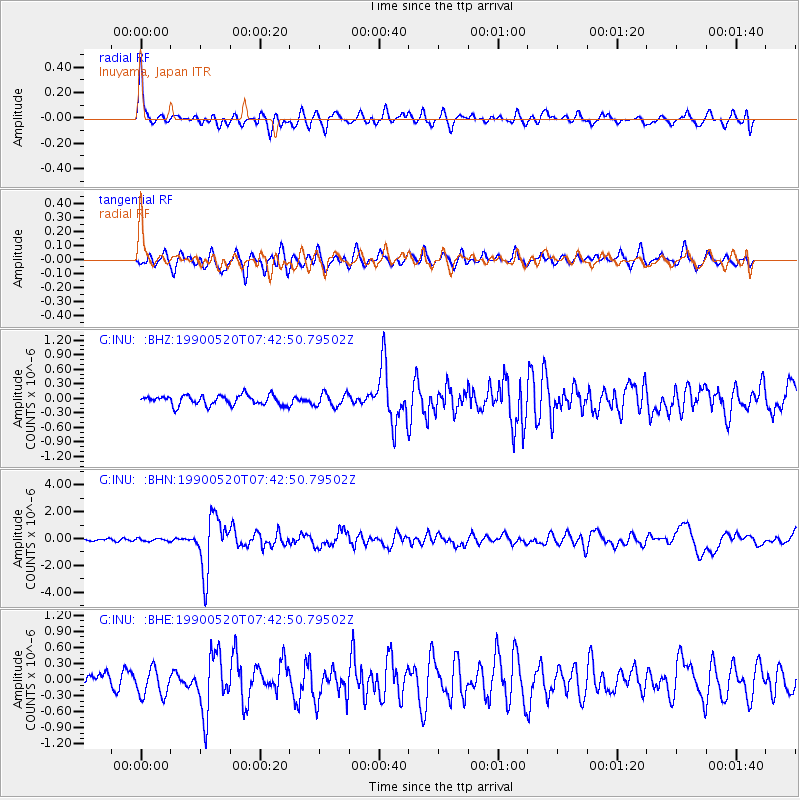
INU Inuyama, Japan - Earthquake Result Viewer
*The percent match for this event was below the threshold and hence no stack was calculated.
| Earthquake location: |
Tonga Islands |
| Earthquake latitude/longitude: |
-18.1/-175.3 |
| Earthquake time(UTC): |
1990/05/20 (140) 07:32:36 GMT |
| Earthquake Depth: |
232 km |
| Earthquake Magnitude: |
5.7 MB |
| Earthquake Catalog/Contributor: |
WHDF/NEIC |
|
| Network: |
G GEOSCOPE |
| Station: |
INU Inuyama, Japan |
| Lat/Lon: |
35.35 N/137.03 E |
| Elevation: |
132 m |
|
| Distance: |
69.7 deg |
| Az: |
319.924 deg |
| Baz: |
131.486 deg |
| Ray Param: |
$rayparam |
*The percent match for this event was below the threshold and hence was not used in the summary stack. |
|
| Radial Match: |
77.53811 % |
| Radial Bump: |
400 |
| Transverse Match: |
72.62877 % |
| Transverse Bump: |
400 |
| SOD ConfigId: |
4480 |
| Insert Time: |
2010-02-26 23:28:35.912 +0000 |
| GWidth: |
2.5 |
| Max Bumps: |
400 |
| Tol: |
0.001 |
|
Signal To Noise
| Channel | StoN | STA | LTA |
| G:INU: :BHN:19900520T07:42:50.79502Z | 0.7839269 | 1.0357006E-7 | 1.3211698E-7 |
| G:INU: :BHE:19900520T07:42:50.79502Z | 2.078785 | 2.6565323E-7 | 1.2779255E-7 |
| G:INU: :BHZ:19900520T07:42:50.79502Z | 1.3267925 | 1.3268047E-7 | 1.0000092E-7 |
| Arrivals |
| Ps | |
| PpPs | |
| PsPs/PpSs | |


