You are here: Home > Network List > G - GEOSCOPE Stations List
> Station INU Inuyama, Japan > Earthquake Result Viewer
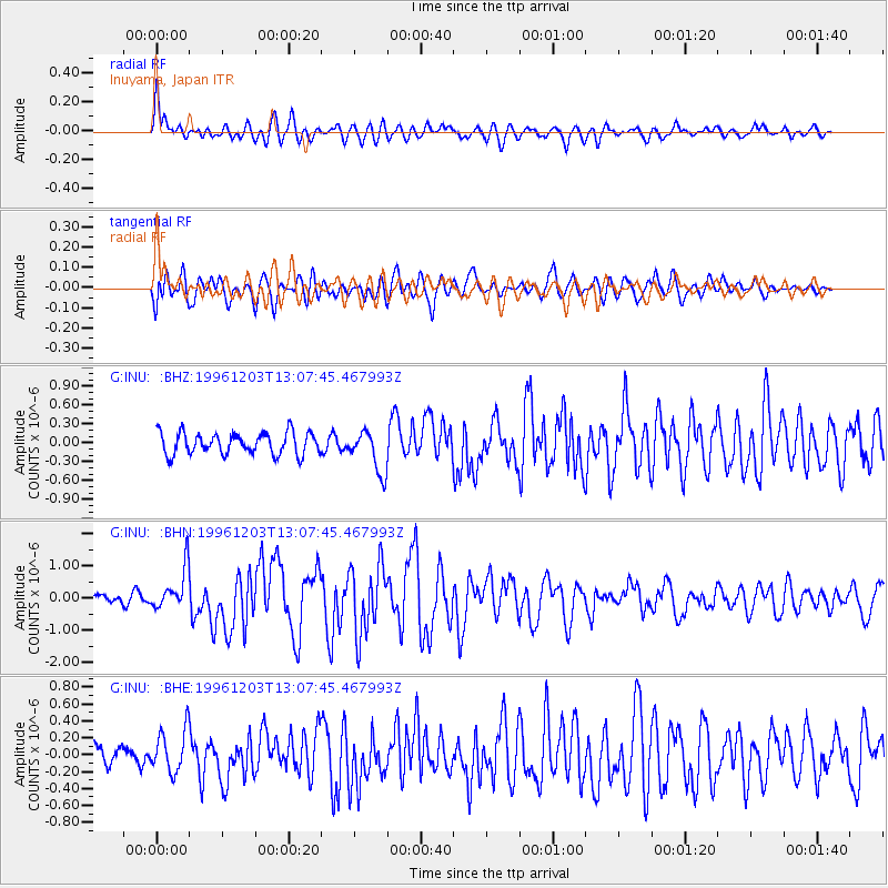
INU Inuyama, Japan - Earthquake Result Viewer
*The percent match for this event was below the threshold and hence no stack was calculated.
| Earthquake location: |
Tonga Islands Region |
| Earthquake latitude/longitude: |
-18.4/-172.3 |
| Earthquake time(UTC): |
1996/12/03 (338) 12:56:56 GMT |
| Earthquake Depth: |
33 km |
| Earthquake Magnitude: |
6.0 MB, 6.0 MS, 6.1 UNKNOWN, 6.1 MW |
| Earthquake Catalog/Contributor: |
WHDF/NEIC |
|
| Network: |
G GEOSCOPE |
| Station: |
INU Inuyama, Japan |
| Lat/Lon: |
35.35 N/137.03 E |
| Elevation: |
132 m |
|
| Distance: |
71.8 deg |
| Az: |
318.266 deg |
| Baz: |
129.337 deg |
| Ray Param: |
$rayparam |
*The percent match for this event was below the threshold and hence was not used in the summary stack. |
|
| Radial Match: |
74.63988 % |
| Radial Bump: |
400 |
| Transverse Match: |
67.66315 % |
| Transverse Bump: |
400 |
| SOD ConfigId: |
4480 |
| Insert Time: |
2010-02-26 23:28:36.600 +0000 |
| GWidth: |
2.5 |
| Max Bumps: |
400 |
| Tol: |
0.001 |
|
Signal To Noise
| Channel | StoN | STA | LTA |
| G:INU: :BHN:19961203T13:07:45.467993Z | 3.078211 | 6.332381E-7 | 2.0571628E-7 |
| G:INU: :BHE:19961203T13:07:45.467993Z | 1.8966646 | 2.5079802E-7 | 1.322311E-7 |
| G:INU: :BHZ:19961203T13:07:45.467993Z | 1.937633 | 3.347313E-7 | 1.7275269E-7 |
| Arrivals |
| Ps | |
| PpPs | |
| PsPs/PpSs | |


