You are here: Home > Network List > TA - USArray Transportable Network (new EarthScope stations) Stations List
> Station W42A Bald Knob, AR, USA > Earthquake Result Viewer
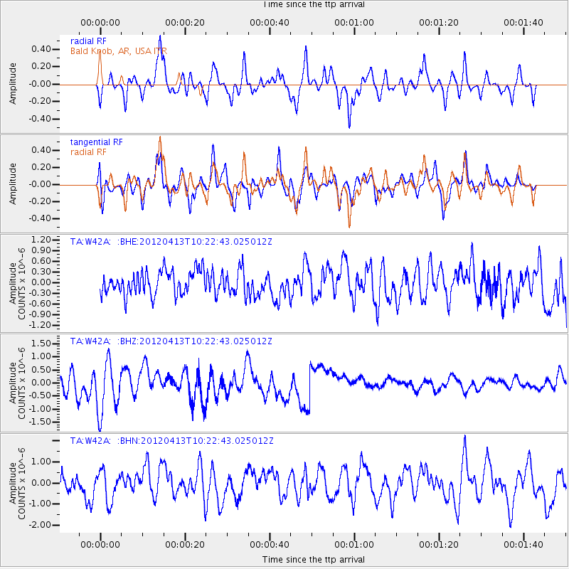
W42A Bald Knob, AR, USA - Earthquake Result Viewer
*The percent match for this event was below the threshold and hence no stack was calculated.
| Earthquake location: |
Near East Coast Of Honshu, Japan |
| Earthquake latitude/longitude: |
37.0/141.2 |
| Earthquake time(UTC): |
2012/04/13 (104) 10:10:01 GMT |
| Earthquake Depth: |
11 km |
| Earthquake Magnitude: |
5.6 MB, 5.4 MS, 5.7 MW, 5.7 MW |
| Earthquake Catalog/Contributor: |
WHDF/NEIC |
|
| Network: |
TA USArray Transportable Network (new EarthScope stations) |
| Station: |
W42A Bald Knob, AR, USA |
| Lat/Lon: |
35.27 N/91.52 W |
| Elevation: |
71 m |
|
| Distance: |
93.0 deg |
| Az: |
40.66 deg |
| Baz: |
320.386 deg |
| Ray Param: |
$rayparam |
*The percent match for this event was below the threshold and hence was not used in the summary stack. |
|
| Radial Match: |
58.02708 % |
| Radial Bump: |
400 |
| Transverse Match: |
61.792656 % |
| Transverse Bump: |
400 |
| SOD ConfigId: |
446234 |
| Insert Time: |
2012-07-04 12:00:01.124 +0000 |
| GWidth: |
2.5 |
| Max Bumps: |
400 |
| Tol: |
0.001 |
|
Signal To Noise
| Channel | StoN | STA | LTA |
| TA:W42A: :BHZ:20120413T10:22:43.025012Z | 2.4422455 | 1.0152819E-6 | 4.1571658E-7 |
| TA:W42A: :BHN:20120413T10:22:43.025012Z | 1.9082458 | 7.374151E-7 | 3.8643614E-7 |
| TA:W42A: :BHE:20120413T10:22:43.025012Z | 1.1040192 | 3.5901112E-7 | 3.2518562E-7 |
| Arrivals |
| Ps | |
| PpPs | |
| PsPs/PpSs | |


