You are here: Home > Network List > TA - USArray Transportable Network (new EarthScope stations) Stations List
> Station F41A Wisconsin Rapids, WI, USA > Earthquake Result Viewer
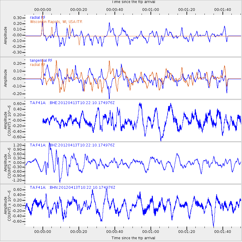
F41A Wisconsin Rapids, WI, USA - Earthquake Result Viewer
*The percent match for this event was below the threshold and hence no stack was calculated.
| Earthquake location: |
Near East Coast Of Honshu, Japan |
| Earthquake latitude/longitude: |
37.0/141.2 |
| Earthquake time(UTC): |
2012/04/13 (104) 10:10:01 GMT |
| Earthquake Depth: |
11 km |
| Earthquake Magnitude: |
5.6 MB, 5.4 MS, 5.7 MW, 5.7 MW |
| Earthquake Catalog/Contributor: |
WHDF/NEIC |
|
| Network: |
TA USArray Transportable Network (new EarthScope stations) |
| Station: |
F41A Wisconsin Rapids, WI, USA |
| Lat/Lon: |
45.74 N/89.10 W |
| Elevation: |
509 m |
|
| Distance: |
86.0 deg |
| Az: |
32.669 deg |
| Baz: |
321.892 deg |
| Ray Param: |
$rayparam |
*The percent match for this event was below the threshold and hence was not used in the summary stack. |
|
| Radial Match: |
63.058636 % |
| Radial Bump: |
400 |
| Transverse Match: |
64.85343 % |
| Transverse Bump: |
400 |
| SOD ConfigId: |
446234 |
| Insert Time: |
2012-07-04 12:01:50.888 +0000 |
| GWidth: |
2.5 |
| Max Bumps: |
400 |
| Tol: |
0.001 |
|
Signal To Noise
| Channel | StoN | STA | LTA |
| TA:F41A: :BHZ:20120413T10:22:10.174976Z | 4.8304014 | 6.546133E-7 | 1.3551944E-7 |
| TA:F41A: :BHN:20120413T10:22:10.174976Z | 1.3419143 | 2.1066353E-7 | 1.5698733E-7 |
| TA:F41A: :BHE:20120413T10:22:10.174976Z | 2.1841605 | 2.5567104E-7 | 1.1705689E-7 |
| Arrivals |
| Ps | |
| PpPs | |
| PsPs/PpSs | |


