You are here: Home > Network List > TA - USArray Transportable Network (new EarthScope stations) Stations List
> Station X44A Crenshaw, MS, USA > Earthquake Result Viewer
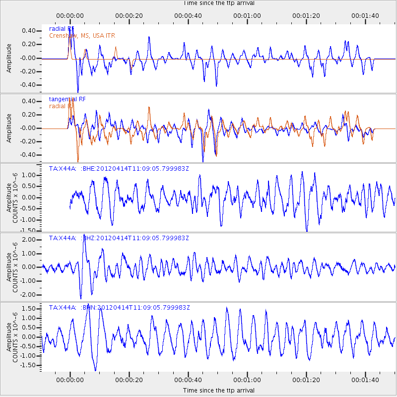
X44A Crenshaw, MS, USA - Earthquake Result Viewer
*The percent match for this event was below the threshold and hence no stack was calculated.
| Earthquake location: |
Drake Passage |
| Earthquake latitude/longitude: |
-57.7/-65.3 |
| Earthquake time(UTC): |
2012/04/14 (105) 10:56:19 GMT |
| Earthquake Depth: |
15 km |
| Earthquake Magnitude: |
6.1 MB, 6.1 MS, 6.2 MW, 6.2 MW |
| Earthquake Catalog/Contributor: |
WHDF/NEIC |
|
| Network: |
TA USArray Transportable Network (new EarthScope stations) |
| Station: |
X44A Crenshaw, MS, USA |
| Lat/Lon: |
34.50 N/90.15 W |
| Elevation: |
109 m |
|
| Distance: |
94.2 deg |
| Az: |
339.644 deg |
| Baz: |
166.923 deg |
| Ray Param: |
$rayparam |
*The percent match for this event was below the threshold and hence was not used in the summary stack. |
|
| Radial Match: |
67.7523 % |
| Radial Bump: |
366 |
| Transverse Match: |
57.020252 % |
| Transverse Bump: |
368 |
| SOD ConfigId: |
446234 |
| Insert Time: |
2012-07-04 12:23:39.258 +0000 |
| GWidth: |
2.5 |
| Max Bumps: |
400 |
| Tol: |
0.001 |
|
Signal To Noise
| Channel | StoN | STA | LTA |
| TA:X44A: :BHZ:20120414T11:09:05.799983Z | 6.9459496 | 9.875322E-7 | 1.4217382E-7 |
| TA:X44A: :BHN:20120414T11:09:05.799983Z | 1.3088194 | 5.826301E-7 | 4.4515696E-7 |
| TA:X44A: :BHE:20120414T11:09:05.799983Z | 0.69932675 | 3.3688485E-7 | 4.817274E-7 |
| Arrivals |
| Ps | |
| PpPs | |
| PsPs/PpSs | |


