You are here: Home > Network List > TA - USArray Transportable Network (new EarthScope stations) Stations List
> Station T44A Benton, MO, USA > Earthquake Result Viewer
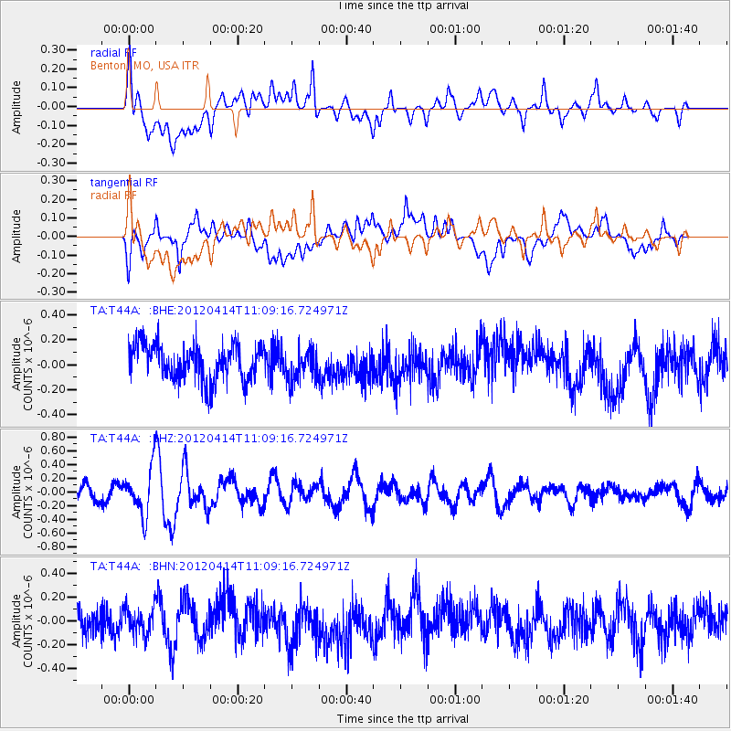
T44A Benton, MO, USA - Earthquake Result Viewer
*The percent match for this event was below the threshold and hence no stack was calculated.
| Earthquake location: |
Drake Passage |
| Earthquake latitude/longitude: |
-57.7/-65.3 |
| Earthquake time(UTC): |
2012/04/14 (105) 10:56:19 GMT |
| Earthquake Depth: |
15 km |
| Earthquake Magnitude: |
6.1 MB, 6.1 MS, 6.2 MW, 6.2 MW |
| Earthquake Catalog/Contributor: |
WHDF/NEIC |
|
| Network: |
TA USArray Transportable Network (new EarthScope stations) |
| Station: |
T44A Benton, MO, USA |
| Lat/Lon: |
37.09 N/89.59 W |
| Elevation: |
133 m |
|
| Distance: |
96.6 deg |
| Az: |
340.669 deg |
| Baz: |
167.151 deg |
| Ray Param: |
$rayparam |
*The percent match for this event was below the threshold and hence was not used in the summary stack. |
|
| Radial Match: |
57.755306 % |
| Radial Bump: |
400 |
| Transverse Match: |
60.82834 % |
| Transverse Bump: |
400 |
| SOD ConfigId: |
446234 |
| Insert Time: |
2012-07-04 12:25:18.854 +0000 |
| GWidth: |
2.5 |
| Max Bumps: |
400 |
| Tol: |
0.001 |
|
Signal To Noise
| Channel | StoN | STA | LTA |
| TA:T44A: :BHZ:20120414T11:09:16.724971Z | 2.92223 | 3.4921013E-7 | 1.1950124E-7 |
| TA:T44A: :BHN:20120414T11:09:16.724971Z | 0.9887366 | 1.0992422E-7 | 1.1117645E-7 |
| TA:T44A: :BHE:20120414T11:09:16.724971Z | 0.8673561 | 1.2613319E-7 | 1.454226E-7 |
| Arrivals |
| Ps | |
| PpPs | |
| PsPs/PpSs | |


