You are here: Home > Network List > TA - USArray Transportable Network (new EarthScope stations) Stations List
> Station T47A Sharon Grove, KY, USA > Earthquake Result Viewer
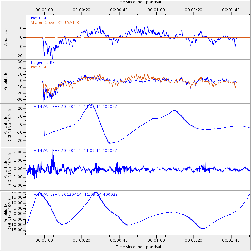
T47A Sharon Grove, KY, USA - Earthquake Result Viewer
*The percent match for this event was below the threshold and hence no stack was calculated.
| Earthquake location: |
Drake Passage |
| Earthquake latitude/longitude: |
-57.7/-65.3 |
| Earthquake time(UTC): |
2012/04/14 (105) 10:56:19 GMT |
| Earthquake Depth: |
15 km |
| Earthquake Magnitude: |
6.1 MB, 6.1 MS, 6.2 MW, 6.2 MW |
| Earthquake Catalog/Contributor: |
WHDF/NEIC |
|
| Network: |
TA USArray Transportable Network (new EarthScope stations) |
| Station: |
T47A Sharon Grove, KY, USA |
| Lat/Lon: |
36.99 N/87.11 W |
| Elevation: |
217 m |
|
| Distance: |
96.1 deg |
| Az: |
342.602 deg |
| Baz: |
168.427 deg |
| Ray Param: |
$rayparam |
*The percent match for this event was below the threshold and hence was not used in the summary stack. |
|
| Radial Match: |
51.26059 % |
| Radial Bump: |
379 |
| Transverse Match: |
75.1045 % |
| Transverse Bump: |
354 |
| SOD ConfigId: |
446234 |
| Insert Time: |
2012-07-04 12:26:57.743 +0000 |
| GWidth: |
2.5 |
| Max Bumps: |
400 |
| Tol: |
0.001 |
|
Signal To Noise
| Channel | StoN | STA | LTA |
| TA:T47A: :BHZ:20120414T11:09:14.40002Z | 2.7189682 | 5.992438E-7 | 2.2039382E-7 |
| TA:T47A: :BHN:20120414T11:09:14.40002Z | 2.9076383 | 2.3470191E-5 | 8.071909E-6 |
| TA:T47A: :BHE:20120414T11:09:14.40002Z | 1.2039893 | 1.310212E-5 | 1.0882256E-5 |
| Arrivals |
| Ps | |
| PpPs | |
| PsPs/PpSs | |


