You are here: Home > Network List > TA - USArray Transportable Network (new EarthScope stations) Stations List
> Station W48A Pulaski, TN, USA > Earthquake Result Viewer
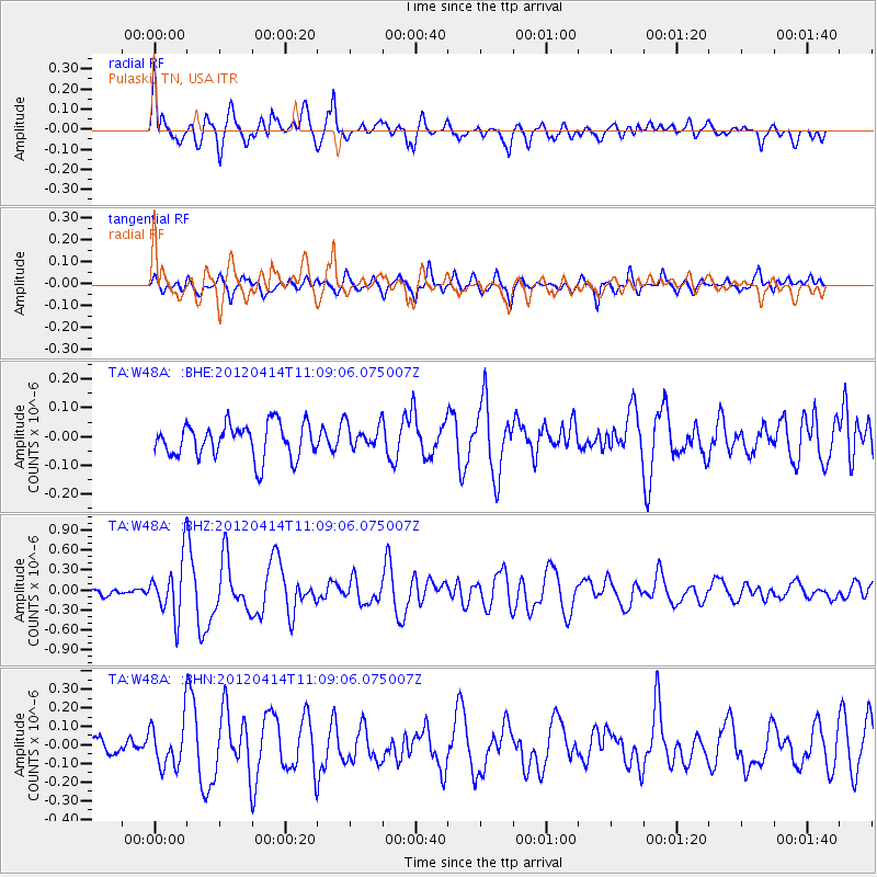
W48A Pulaski, TN, USA - Earthquake Result Viewer
*The percent match for this event was below the threshold and hence no stack was calculated.
| Earthquake location: |
Drake Passage |
| Earthquake latitude/longitude: |
-57.7/-65.3 |
| Earthquake time(UTC): |
2012/04/14 (105) 10:56:19 GMT |
| Earthquake Depth: |
15 km |
| Earthquake Magnitude: |
6.1 MB, 6.1 MS, 6.2 MW, 6.2 MW |
| Earthquake Catalog/Contributor: |
WHDF/NEIC |
|
| Network: |
TA USArray Transportable Network (new EarthScope stations) |
| Station: |
W48A Pulaski, TN, USA |
| Lat/Lon: |
35.14 N/86.93 W |
| Elevation: |
260 m |
|
| Distance: |
94.2 deg |
| Az: |
342.37 deg |
| Baz: |
168.549 deg |
| Ray Param: |
$rayparam |
*The percent match for this event was below the threshold and hence was not used in the summary stack. |
|
| Radial Match: |
78.54911 % |
| Radial Bump: |
400 |
| Transverse Match: |
63.41205 % |
| Transverse Bump: |
400 |
| SOD ConfigId: |
446234 |
| Insert Time: |
2012-07-04 12:28:33.520 +0000 |
| GWidth: |
2.5 |
| Max Bumps: |
400 |
| Tol: |
0.001 |
|
Signal To Noise
| Channel | StoN | STA | LTA |
| TA:W48A: :BHZ:20120414T11:09:06.075007Z | 6.159904 | 4.2598194E-7 | 6.915399E-8 |
| TA:W48A: :BHN:20120414T11:09:06.075007Z | 1.6621068 | 1.2331807E-7 | 7.4193835E-8 |
| TA:W48A: :BHE:20120414T11:09:06.075007Z | 0.75474805 | 4.3933355E-8 | 5.8209295E-8 |
| Arrivals |
| Ps | |
| PpPs | |
| PsPs/PpSs | |


