You are here: Home > Network List > G - GEOSCOPE Stations List
> Station KIP Kipapa, Hawaii, USA > Earthquake Result Viewer
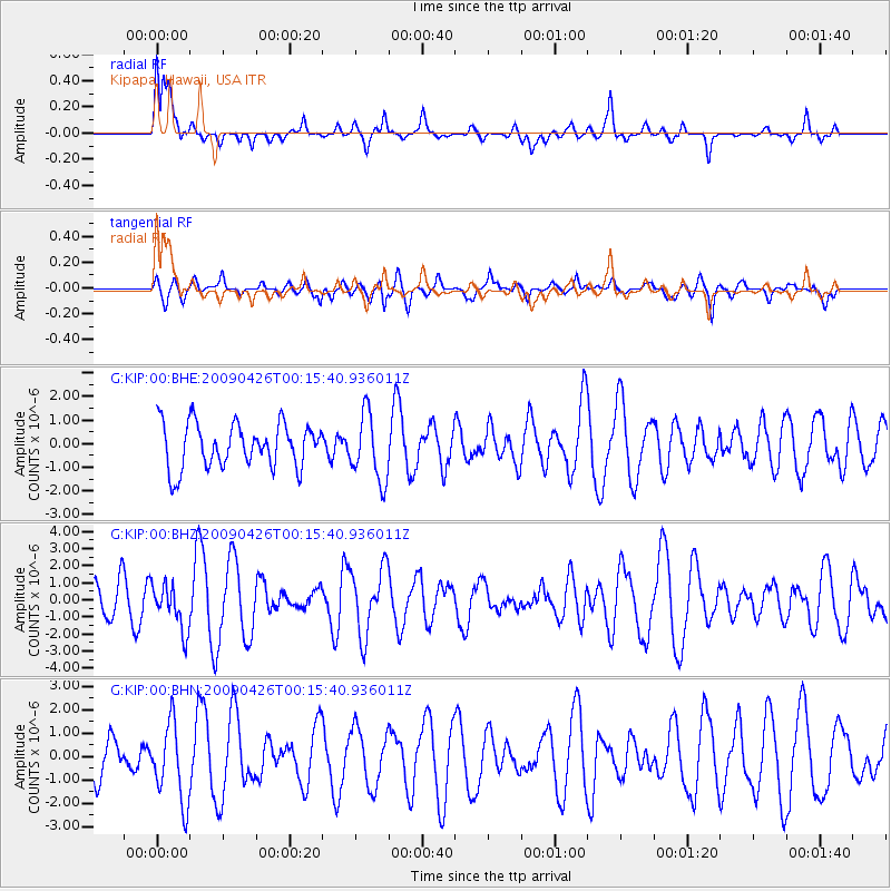
KIP Kipapa, Hawaii, USA - Earthquake Result Viewer
*The percent match for this event was below the threshold and hence no stack was calculated.
| Earthquake location: |
Kermadec Islands, New Zealand |
| Earthquake latitude/longitude: |
-30.3/-178.6 |
| Earthquake time(UTC): |
2009/04/26 (116) 00:06:53 GMT |
| Earthquake Depth: |
132 km |
| Earthquake Magnitude: |
5.5 MB, 6.1 MW, 6.1 MW |
| Earthquake Catalog/Contributor: |
WHDF/NEIC |
|
| Network: |
G GEOSCOPE |
| Station: |
KIP Kipapa, Hawaii, USA |
| Lat/Lon: |
21.42 N/158.01 W |
| Elevation: |
70 m |
|
| Distance: |
55.1 deg |
| Az: |
23.522 deg |
| Baz: |
201.744 deg |
| Ray Param: |
$rayparam |
*The percent match for this event was below the threshold and hence was not used in the summary stack. |
|
| Radial Match: |
60.374676 % |
| Radial Bump: |
400 |
| Transverse Match: |
50.744133 % |
| Transverse Bump: |
400 |
| SOD ConfigId: |
2658 |
| Insert Time: |
2010-02-26 23:29:30.862 +0000 |
| GWidth: |
2.5 |
| Max Bumps: |
400 |
| Tol: |
0.001 |
|
Signal To Noise
| Channel | StoN | STA | LTA |
| G:KIP:00:BHZ:20090426T00:15:40.936011Z | 0.8915228 | 1.3513735E-6 | 1.5158035E-6 |
| G:KIP:00:BHN:20090426T00:15:40.936011Z | 2.3145883 | 1.6692351E-6 | 7.211801E-7 |
| G:KIP:00:BHE:20090426T00:15:40.936011Z | 1.5152904 | 1.4211926E-6 | 9.379011E-7 |
| Arrivals |
| Ps | |
| PpPs | |
| PsPs/PpSs | |


