You are here: Home > Network List > G - GEOSCOPE Stations List
> Station KIP Kipapa, Hawai, U.S.A. (Pacific Ocean) > Earthquake Result Viewer
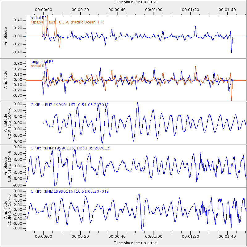
KIP Kipapa, Hawai, U.S.A. (Pacific Ocean) - Earthquake Result Viewer
*The percent match for this event was below the threshold and hence no stack was calculated.
| Earthquake location: |
Gulf Of Alaska |
| Earthquake latitude/longitude: |
56.2/-147.4 |
| Earthquake time(UTC): |
1999/01/16 (016) 10:44:39 GMT |
| Earthquake Depth: |
21 km |
| Earthquake Magnitude: |
5.9 MB, 5.7 MS, 6.0 MW, 6.0 ME |
| Earthquake Catalog/Contributor: |
WHDF/NEIC |
|
| Network: |
G GEOSCOPE |
| Station: |
KIP Kipapa, Hawai, U.S.A. (Pacific Ocean) |
| Lat/Lon: |
21.42 N/158.01 W |
| Elevation: |
70 m |
|
| Distance: |
35.6 deg |
| Az: |
197.085 deg |
| Baz: |
10.141 deg |
| Ray Param: |
$rayparam |
*The percent match for this event was below the threshold and hence was not used in the summary stack. |
|
| Radial Match: |
53.11959 % |
| Radial Bump: |
400 |
| Transverse Match: |
58.78062 % |
| Transverse Bump: |
380 |
| SOD ConfigId: |
4480 |
| Insert Time: |
2010-02-26 23:29:32.183 +0000 |
| GWidth: |
2.5 |
| Max Bumps: |
400 |
| Tol: |
0.001 |
|
Signal To Noise
| Channel | StoN | STA | LTA |
| G:KIP: :BHN:19990116T10:51:05.20701Z | 0.66833365 | 3.554487E-6 | 5.3184317E-6 |
| G:KIP: :BHE:19990116T10:51:05.20701Z | 0.75699556 | 1.9910597E-6 | 2.6302132E-6 |
| G:KIP: :BHZ:19990116T10:51:05.20701Z | 1.9607459 | 6.465286E-6 | 3.2973603E-6 |
| Arrivals |
| Ps | |
| PpPs | |
| PsPs/PpSs | |


