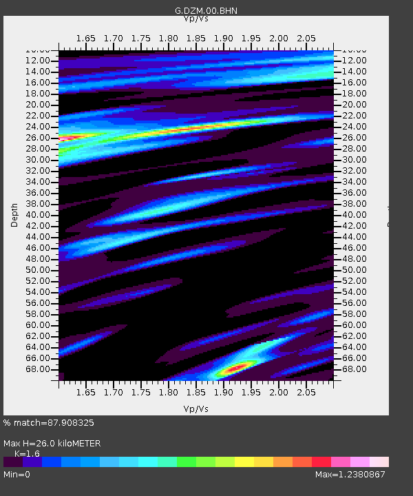
DZM Dzumac, New Caledonia - Earthquake Result Viewer
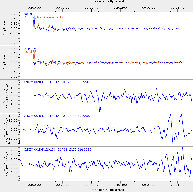
Earthquake location: Irian Jaya Region, Indonesia
Earthquake latitude/longitude: -1.6/134.3
Earthquake time(UTC): 2012/04/21 (112) 01:16:52 GMT
Earthquake Depth: 16 km
Earthquake Magnitude: 6.3 MB, 6.6 MS, 6.7 MW, 6.6 MW
Earthquake Catalog/Contributor: WHDF/NEIC
Network: G GEOSCOPE
Station: DZM Dzumac, New Caledonia
Lat/Lon: 22.07 S/166.44 E
Elevation: 878 m
Distance: 37.3 deg
Az: 125.438 deg
Baz: 298.597 deg
Ray Param: 0.0761907
Estimated Moho Depth: 26.0 km
Estimated Crust Vp/Vs: 1.60
Assumed Crust Vp: 5.14 km/s
Estimated Crust Vs: 3.212 km/s
Estimated Crust Poisson's Ratio: 0.18
Radial Match: 87.908325 %
Radial Bump: 400
Transverse Match: 73.56021 %
Transverse Bump: 400
SOD ConfigId: 446234
Insert Time: 2012-07-13 14:21:40.258 +0000
GWidth: 2.5
Max Bumps: 400
Tol: 0.001

Signal To Noise

ChannelStoNSTALTA
G:DZM:00:BHZ:20120421T01:23:33.299998Z3.37598822.5578822E-67.5766917E-7
G:DZM:00:BHN:20120421T01:23:33.299998Z1.16354071.5211289E-61.3073276E-6
G:DZM:00:BHE:20120421T01:23:33.299998Z1.57006341.2498247E-67.9603456E-7
Arrivals
Ps3.2 SECOND
PpPs13 SECOND
PsPs/PpSs16 SECOND