You are here: Home > Network List > UW - Pacific Northwest Regional Seismic Network Stations List
> Station MRBL Marblemount, WA, USA > Earthquake Result Viewer
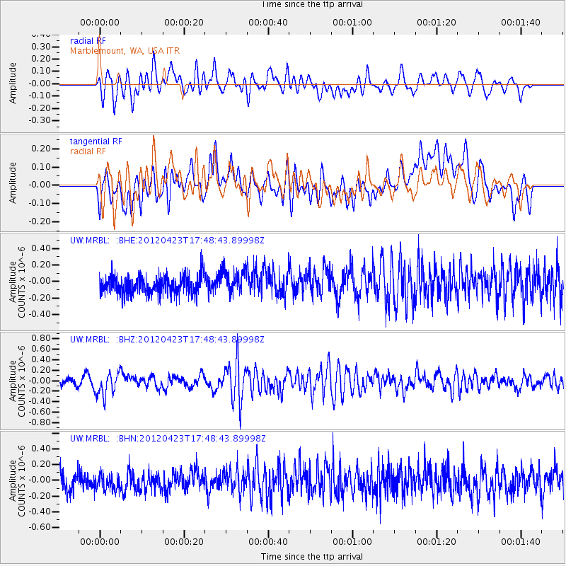
MRBL Marblemount, WA, USA - Earthquake Result Viewer
*The percent match for this event was below the threshold and hence no stack was calculated.
| Earthquake location: |
Kermadec Islands Region |
| Earthquake latitude/longitude: |
-28.6/-177.4 |
| Earthquake time(UTC): |
2012/04/23 (114) 17:36:21 GMT |
| Earthquake Depth: |
114 km |
| Earthquake Magnitude: |
5.8 MB, 6.0 MW, 6.0 MW |
| Earthquake Catalog/Contributor: |
WHDF/NEIC |
|
| Network: |
UW Pacific Northwest Regional Seismic Network |
| Station: |
MRBL Marblemount, WA, USA |
| Lat/Lon: |
48.52 N/121.48 W |
| Elevation: |
75 m |
|
| Distance: |
91.6 deg |
| Az: |
33.432 deg |
| Baz: |
226.799 deg |
| Ray Param: |
$rayparam |
*The percent match for this event was below the threshold and hence was not used in the summary stack. |
|
| Radial Match: |
62.46228 % |
| Radial Bump: |
400 |
| Transverse Match: |
50.682114 % |
| Transverse Bump: |
400 |
| SOD ConfigId: |
446234 |
| Insert Time: |
2012-07-21 12:34:56.380 +0000 |
| GWidth: |
2.5 |
| Max Bumps: |
400 |
| Tol: |
0.001 |
|
Signal To Noise
| Channel | StoN | STA | LTA |
| UW:MRBL: :BHZ:20120423T17:48:43.89998Z | 2.7192311 | 2.2650718E-7 | 8.329825E-8 |
| UW:MRBL: :BHN:20120423T17:48:43.89998Z | 0.96244425 | 1.0974281E-7 | 1.14025106E-7 |
| UW:MRBL: :BHE:20120423T17:48:43.89998Z | 1.3486605 | 1.4560014E-7 | 1.07959075E-7 |
| Arrivals |
| Ps | |
| PpPs | |
| PsPs/PpSs | |


